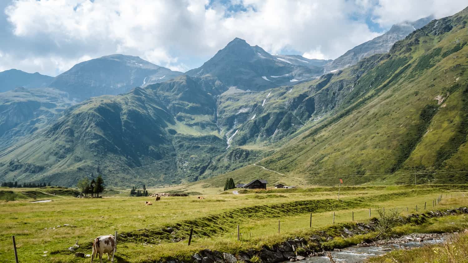
Hohe Tauern, Austria – imagine imposing peaks reaching for the clouds, lakes clear as crystal, flower meadows spreading out under blue skies and lush alpine pastures where animals graze contentedly. Are you going on a trip to the Alps and looking for tips for hiking and walking? Here is a list of 19 things to do in Hohe Tauern, Austria.
- Interesting facts about Hohe Tauern, Austria
- Hiking trails and things to do in Hohe Tauern, Austria
- 1. Kitzsteinhorn Glacier
- 2. Wasserfallboden and Mooserboden dams
- 3. The Grossglockner Alpine Road and the Pasterze Glacier
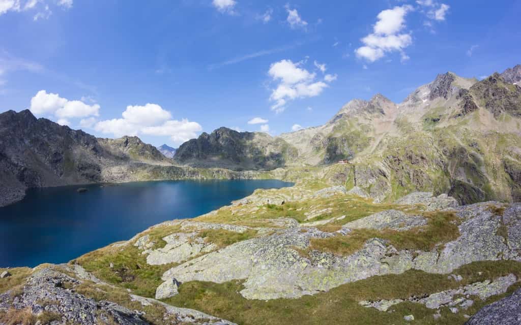
- 4. Lakes Grünsee, Weißsee and Tauernmoossee
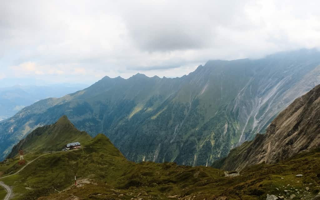
- 5. Jagdhausalmen – the best things to do in the Hohe Tauern
- 6. The Gschlösstal Valley and the Schlatenkees Glacier
- 7. Dabakklamm and Dorfer See
- 8. Umbalfälle Nature Trail
- 9. Bad Gastein
- 10. Mittersill National Park Centre
- 11. Lakes Kreuzsee and Wangenitzsee
- 12. Krimml Waterfalls – things to do in the Hohe Tauern
- 13. Sigmund Thun Klamm
- 14. Seebachtal Valley
- 15. Malta Hochalmstrasse and Kölnbreinsperre Dam
- 16. Rauristal Valley
- 17. Stubnerkogel
- 18. Kitzlochklamm
- 19. Sportgastein – things to do in Hohe Tauern
- Where to stay in the Hohe Tauern
- Hiking in Hohe Tauern
- High Tauern, Austria – map
- Transport in Austria
- When to visit the Hohe Tauern
- More information about the Alps
Interesting facts about Hohe Tauern, Austria
With an area of 1856 m2, the Hohe Tauern is the largest national park in the Alps and the first national park in Austria. It forms the imaginary backbone of the Austrian Alps, on the border of the three Austrian states of Salzburg, Tyrol and Carinthia.
The area is home to an incredible 266 peaks that boast an elevation of over 3,000 metres. Among them is the Grossglockner, Austria’s highest mountain, which rises to 3,798 metres above sea level.
The Hohe Tauern region is also home to 15,000 to 20,000 animal species, 4,000 species of fungi and 3,500 species of plants, testifying to the incredible biodiversity of the region. The area is also a refuge for animals that were in the early 19th century, almost extinct in Europe.
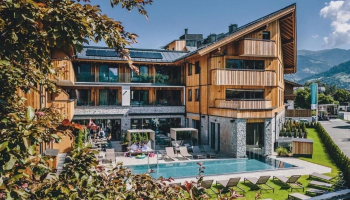
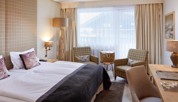
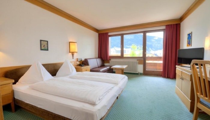
Hotels High Tauren 😴
These accommodations include the SommerCard, which gives you free access to cable cars, public transport and attractions in the Zell am See-Kaprun area. The card is valid from 15th May to 31th October.
Note: Time and distance are calculated in the outbound direction unless otherwise stated.
Hiking trails and things to do in Hohe Tauern, Austria
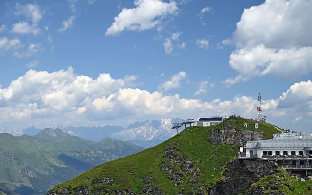
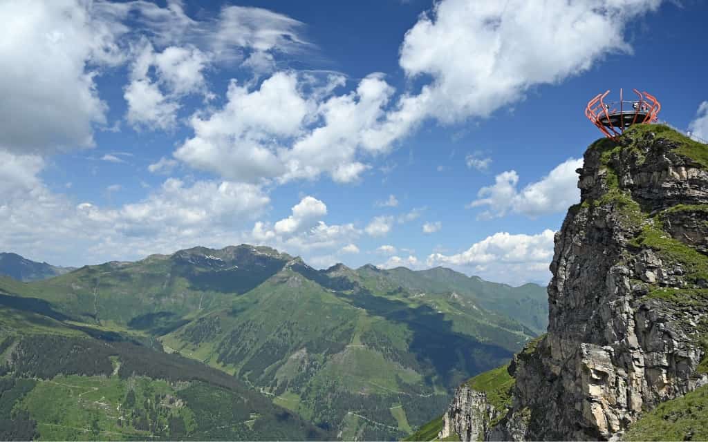
1. Kitzsteinhorn Glacier
The Kitzsteinhorn glacier (3202 m) is one of the most popular places in Austria for year-round skiing. In addition, there are plenty of other things to do – explore the Alps from the Summit World 3000 viewpoint, hike one of the hiking trails or rent a mountain bike and ride the trails.
More information about the Kitzsteinhorn glacier can be found here.
How to get to Kitzsteinhorn, Hohe Tauern
The lower station of the Kitzsteinhorn cable car is located outside Kaprun. You can take the regional bus no. 660, which departs from Zell am See, Kaprun and also stops at the lower station of the cable car (further on it goes to the Kaprun dams – see next point). If you are driving, there are large free car parks.
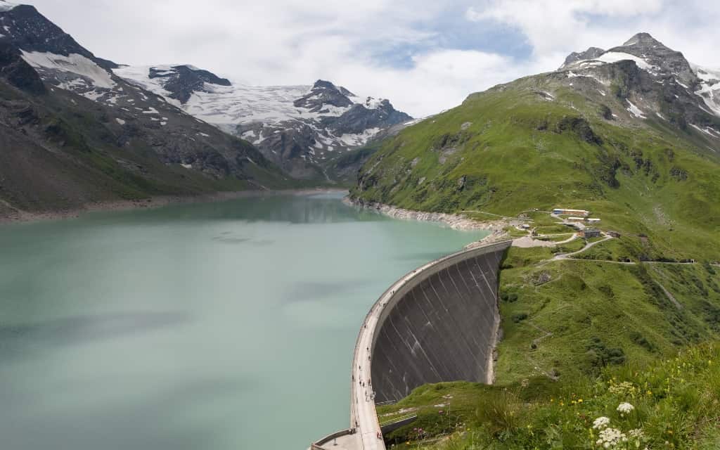
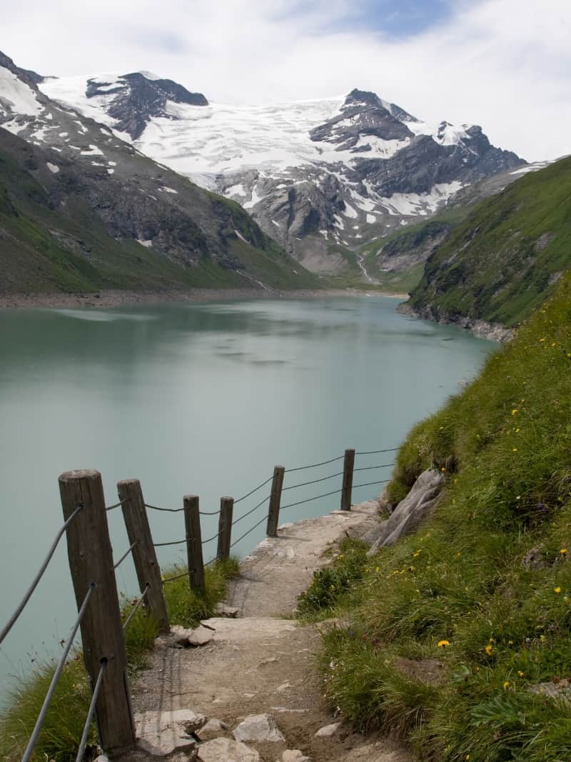
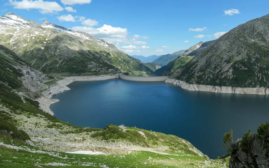
2. Wasserfallboden and Mooserboden dams
Looking at Wasserfallboden (1672 m) and Mooserboden (2036 m), the high mountain dams in Kaprun, I fell in love with the Alps for the first time.
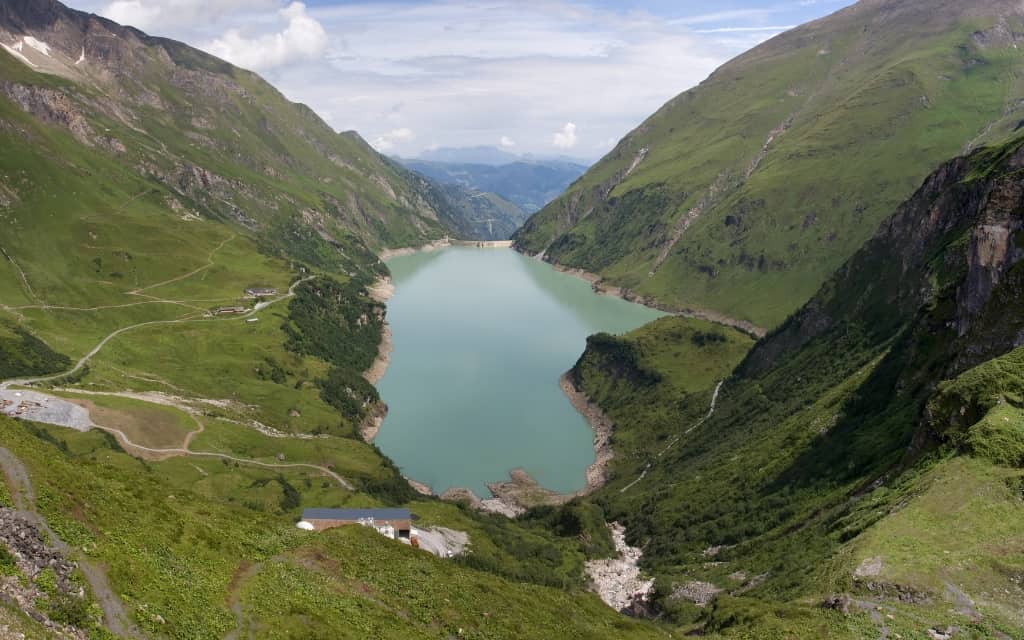
At the Mooserboden Dam, you can learn more about electricity generation at the visitor centre and take a peek behind the scenes of hydroelectric power generation with a tour of the dam. Don’t miss the Stromi Children’s Nature Trail with your children, where they will learn more about the relationship between nature and technology.
Breathtaking hiking trails wind through the area and you can also try MOBO 107, the highest ferrata on the dam wall. Refreshments are available in one of the mountain huts.
How to get to the Mooserboden Dam, Kaprun
The starting point is the Kesselfall ticket office, which can be reached by bus or car. If you choose the bus, regional line no. The 660 runs from Zell am See via Kaprun to the ticket office at the terminus (the same line also takes you to the Kitzsteinhorn). If you drive, you can park here in the parking garage (free of charge).
Cable car
Transfer buses run from the ticket office and take you to the Mooserboden Dam. They don’t have a strict order because they go on a turn. Part of the route is also via an overground cable car, which is the largest open inclined cable car in Europe. From the cable car you can take a bus through the tunnels to the upper reservoir.
The entire route from the ticket office to the dam is part of one price, i.e. one ticket includes a bus from the ticket office – cable car – bus to the reservoir.
On this link you will find up-to-date information on the Mooserboden dam (ticket prices, opening times, cable car, news).
The dams are open from early June to mid-October.
Hike to the Kaprun dams
The other option is to walk – the starting point is again in Kesselfall, from where you follow the red footpath sign that goes around the reservoirs. The trip up takes 4-5 hours depending on fitness and weather. You will overcome an elevation gain of about 1100 metres.
Hiking trails also start at Mooserboden. A special bus service leaves from Kesselfall early in the morning, but you need to book a seat in advance – more info here.
The best accommodation around Zell am See and Kaprun: Elements Resort Zell am See (Zell am See), AvenidA Mountain Lodges (Kaprun), Das Alpenhaus Kaprun (Kaprun)
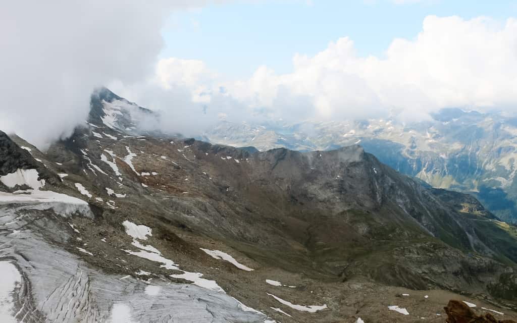
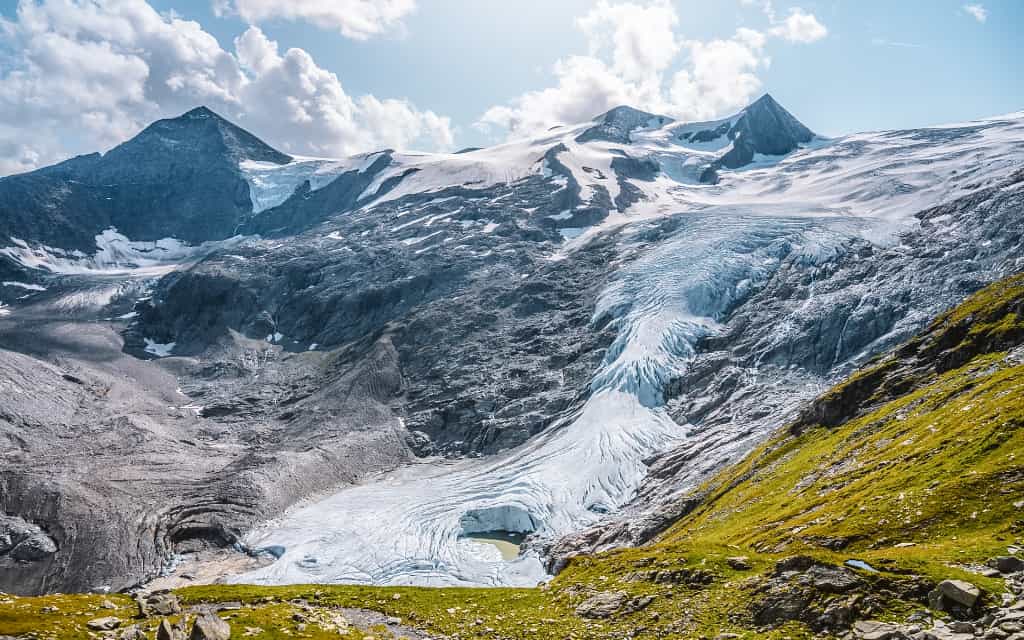
3. The Grossglockner Alpine Road and the Pasterze Glacier
Are you looking for a day trip where you can enjoy the beautiful nature and incredible views from morning till night? Take the Grossglockner Alpine Road, where you will see, among other things, the longest Pasterze glacier in the Hohe Tauern National Park directly below the Grossglockner peak.
The marmots will run around you and you will enjoy the view of the highest peaks of the Austrian Alps. Here you have a unique chance to visit places that are normally inaccessible.
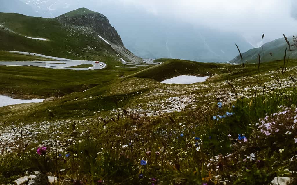
The Grossglockner Alpine Road is one of the most famous and beautiful panoramic roads.
The road is 48 km long and takes you through the national park area between Fusch an der Grossglocknerstrasse in the north and Heiligenblut in the south.
On the way you will count 36 turns and overcome an altitude of 1,748 metres. The usual gradient is 12%. However, the climb is not so significant that most cars cannot handle it. In addition, there are a number of rest areas along the way.
Many cyclists will venture onto this high mountain road, so you need to be cautious when travelling.
Just before the south hill, there is a right turn to reach the Kaiser-Franz-Josefs-Höche lookout. Here you will find clear blue lakes, the Pasterze glacier, waterfalls and a divine view of the Grossglockner.
The Grossglockner Alpine Road is open from May to early November. Many long-distance hiking trails, such as the Glocknerrunde, the Venediger High Trail and the Alpe Adria, pass through the area.
Here you will find the latest information on opening times and prices for the Grossglockner Alpine Road.
Tip: Hotel LukasMayr in Bruck an der Großglocknerstraße is strategically located for the Grossglockner Alpine Road, the Kitzlochklamm Gorge, the Kaprun Dam or the Kitzsteinhorn glacier.
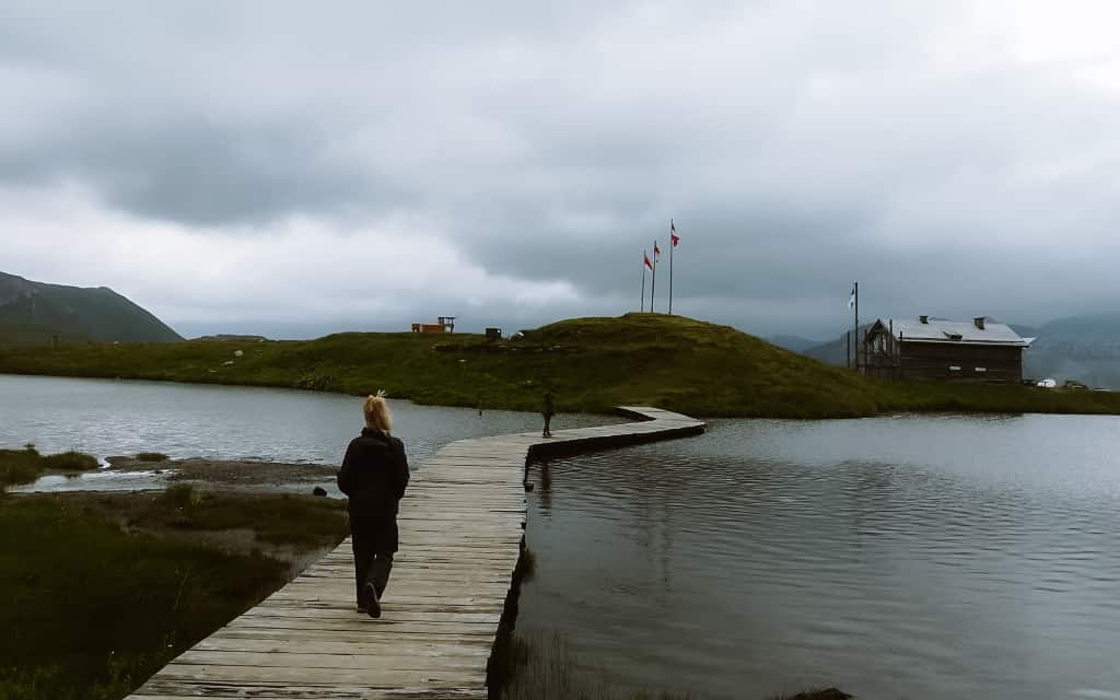
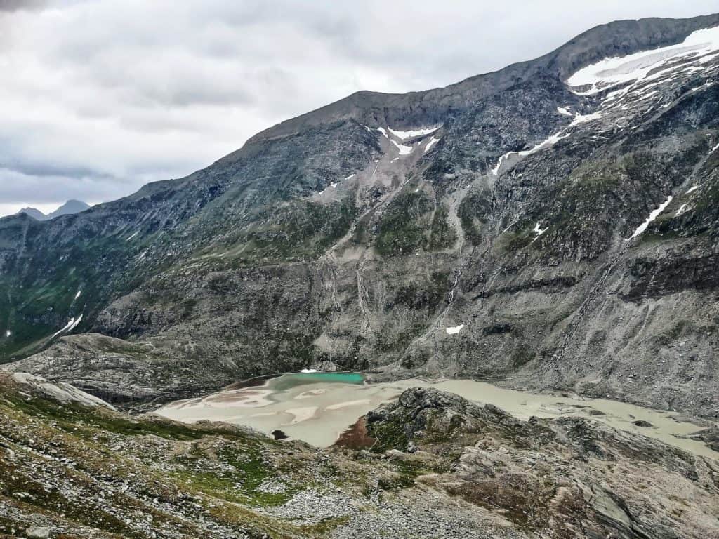
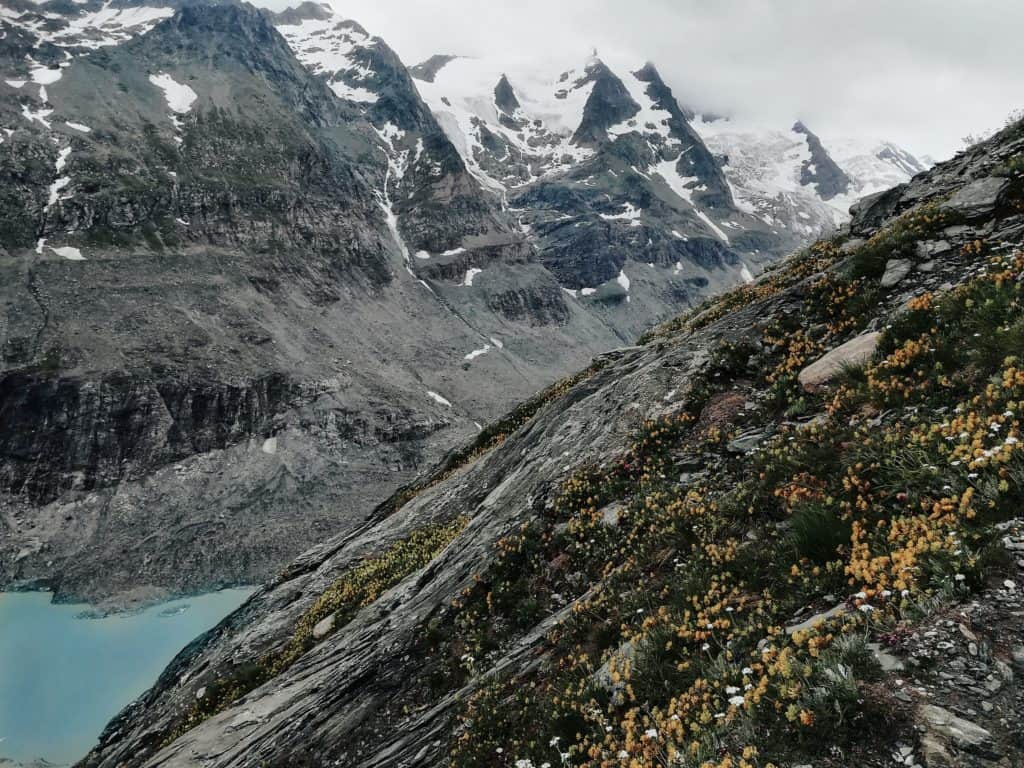
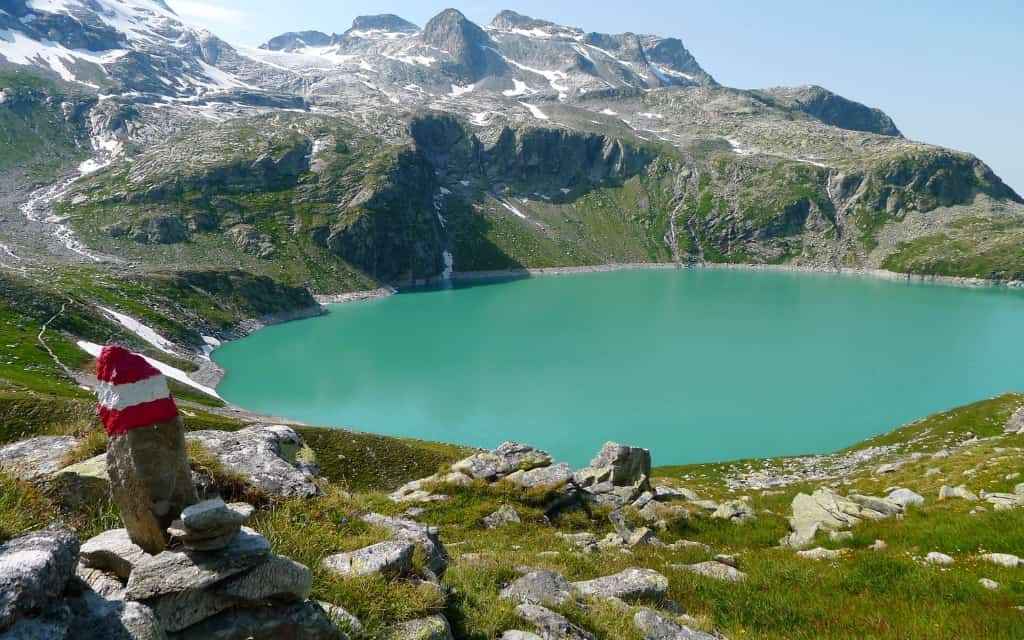
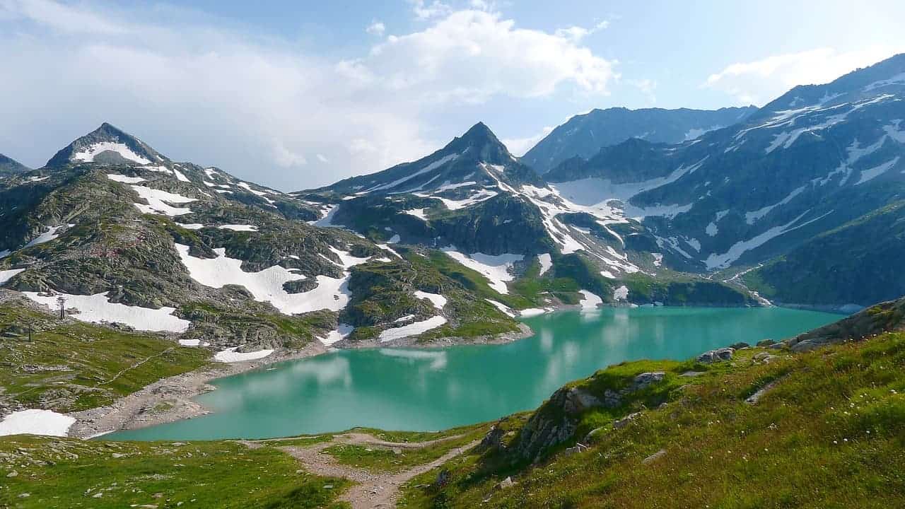
4. Lakes Grünsee, Weißsee and Tauernmoossee
Near the Enzingerboden power station near Uttendorf you will find the beautiful alpine reservoirs Grünsee, Tauernmoossee and especially Weißsee.
The area around the dams is interwoven with hiking trails and the Tauernmoosossee can also be reached by bike. Besides hiking, you can also enjoy great skiing on the Weißsee glacier.
How to get to the Weißsee
The Enzingerboden power station is the starting point because the lower station of the cable car to the Weißsee with a stop at the Grünsee is located here. If you are arriving by car, park in the large free car park. The second option is to take bus no. 672 from Uttendorf, which stops directly at the lower cable car station.
Cable car to the Weißsee
A modern cable car takes you from the car park across the Grünsee to the Weißsee, which is the highest of the three dams. More information about the Weißsee cable car can be found on the official website. There is also a mountain hotel where you can refresh yourself.
Trail to Weißsee, Austria
- Difficulty: moderate
- Time: 2-3 hours
- Distance: 6 km
- Elevation: 800 m
- Starting position: parking lot at the Enzingerboden power plant
If you plan to walk, expect to walk about 2-3 hours with an elevation gain of 800 metres to the Weißsee. Follow trail 715, which takes you to the upper reservoir – the first part of the trail is steeper, but the second part rewards you with beautiful views.
On the way, you can make a detour to the Tauernmoossee dam, which is also beautiful. With the detour, add an extra half hour to an hour. Or stop here on your way down.
The surroundings of the Weißsee are interwoven with hiking trails – easy trails and more demanding hikes, where everyone will find their own.
5. Jagdhausalmen – the best things to do in the Hohe Tauern
- Difficulty: easy
- Time: 2-2.5 hours
- Distance: 6,5 km
- Elevation: 288 m
- Starting point: free parking at the Alpengasthaus Oberhaus, reached via the toll road for 8 €
At the end of the Defereggental valley in East Tyrol lies the oldest mountain village in Austria – Jagdhausalmen. It consists of 15 stone huts and 1 chapel, which are scattered in the picturesque landscape and will transport you to the Tibetan area in no time.
In the past, the cottages were used by settlers as a summer retreat and the local pastures for their cattle. Today, the huts are used for storage, but you can also have refreshments here.
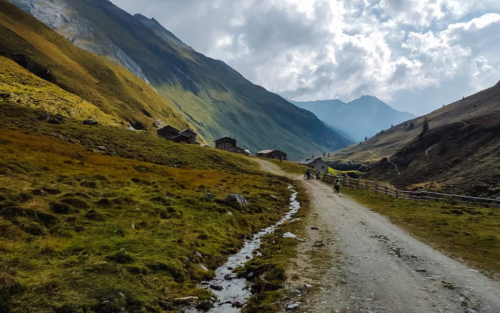
The village can be reached from the car park at the Alpengasthaus Oberhaus, from where you can take the 111 trail around the Schwarzach river (which is also a cycle path).
From the village you can continue to the Arventalm mountain hut (45 minutes extra from the village) or to the Klammlsee – Lago di Gola (30 minutes from the Arventalm mountain hut).
The entire trail from the parking lot through the settlement to the lake is easy without significant elevation gain.
Hotels High Tauren 😴
6. The Gschlösstal Valley and the Schlatenkees Glacier
- Difficulty: easy
- Starting position: parking lot of the Matreier Tauerhaus
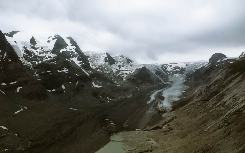
Do you want to see the best of the Hohe Tauern National Park? Head to the Gschlösstal valley to the Schlatenkees glacier in the west of the Hohe Tauern. When you visit the valley, you will understand why it is nicknamed the “Royal Valley of the Eastern Alps”.
A beautiful valley with traditional wooden houses, surrounded by majestic peaks including the Großvenediger, the highest peak of the Venediger. The dominant feature is the Schlatenkees glacier, which winds between the peaks into the valley. Unfortunately, due to global warming, the glacier is constantly shrinking.
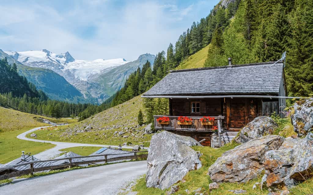
There are several easy and more demanding hiking trails in the vicinity of the valley and the glacier. The most popular is the circular route around the Glacier Gletscherlehrweg Innergschlöss, which takes 4-4.5 hours.
How to get to the Gschlösstal valley and the Schlatenkees glacier
The starting point is the paid parking lot at the Matreier Tauerhaus (parking costs a maximum of € 9 per 24 hours). If you want to take public transport, take bus no. 955 in Matrei in Osttirol, from where it’s just a few minutes to the Matrei in Osttirol Tauernhaus stop (price €5.20 in 2023). You can find the current connections here.
From the car park you can walk or take a taxi. If you go on foot, count on about 1.5 hours to Innergschlöss, the starting point for exploring the valley. Alternatively, take a taxi that serves the area between the car park and the Innergschlöss to the Venedigerhaus. Taxis run every 20 minutes between 8:40-17:00 and cost €6 per person.
Tip: Rustic guesthouse Landgasthof Steiner in Matrei in Osttirol is perfectly located for exploring the western part of the Hohe Tauern (Umbaltal waterfalls, Daberklamm, Jagdhausalm, Schlatenkees glacier).
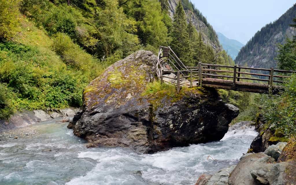
7. Dabakklamm and Dorfer See
- Difficulty: easy, ideal for all ages
- Time: 1-2.5 hours depending on goal and fitness
- Starting point: Tauernwirt Mountain Hotel near Kals am Grossglockner
Dabakklamm is located in the Dorfertal valley north of Kals am Grossglockner. It will take you through the beautiful countryside around the Kalserbach mountain stream, which is the cradle of the Hohe Tauern. The journey through the gorge is not difficult and even children can manage it without any problems. The gorge is open from the beginning of June to mid-October.
Beyond the gorge, you can refresh yourself in the Berger Alm alpine pasture. It takes about an hour to get here. Alternatively, you can continue further to the Kalser Tauernhaus mountain hut and from there to the Dorfer See lake, which is nestled between massive peaks (the route is then about 2.5 hours long from the car park).
The road to the Kalser Tauernhaus is easy with a gradual climb. From the hut to the lake, you will have a higher elevation and more difficult terrain, but bigger children can easily manage it.
How to get to the Dorfertal Valley
The Dorfertal Valley can be reached by car or bus. If you’re driving, park here – there’s a free parking area, but it can fill up early in the season. From the car park you will head to the mountain hotel, which is about 5 minutes away and you can see it from the car park. Here is the entrance to the valley and the gorge.
The second option is regional bus no. 952 from Kals am Großglockner – get off in a few minutes at the stop Kals am Großglockner Taurer. Here you will find the current timetables.
☞ Get inspired by the most beautiful places in Austria.
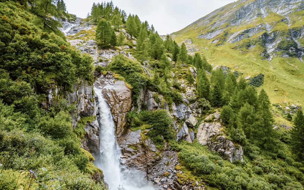
8. Umbalfälle Nature Trail
The Umbalfälle Nature Trail takes you past a group of waterfalls on the Isel River, which you can admire from several viewing platforms. The river is fed by the Umbalkees Glacier. The best time to visit is from mid-May when the water is at its highest after the winter.
- Difficulty from Ströden: easy, 6 km and 2.5 hours in total
- Starting point: Ströden paid car park (8 € in 2023)
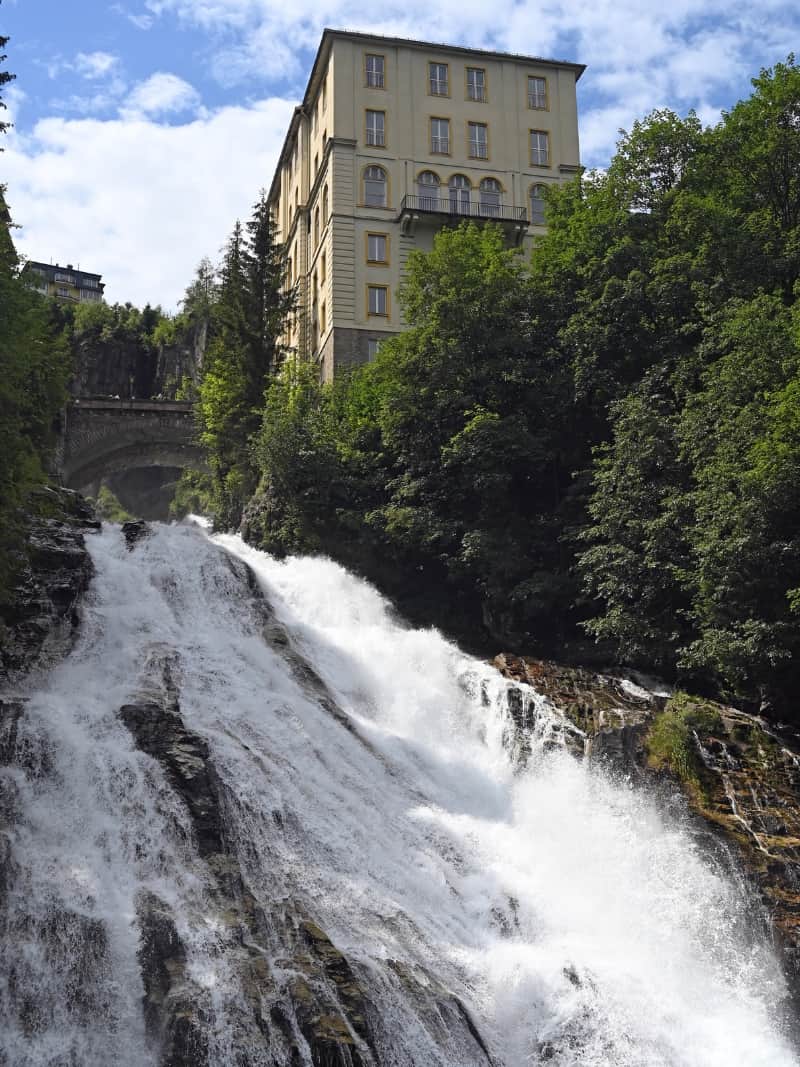
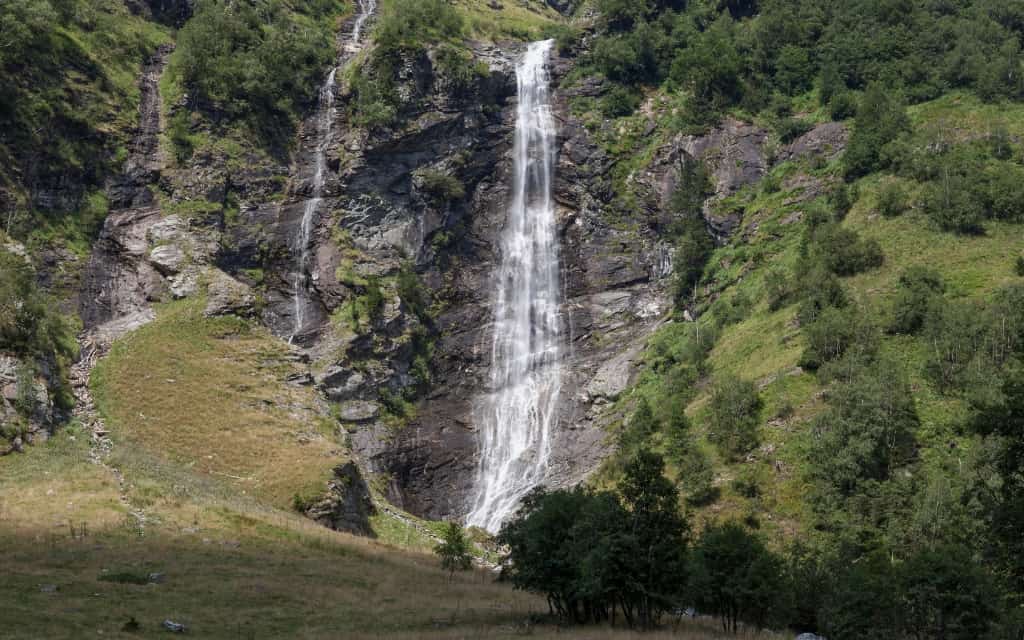
9. Bad Gastein
Bad Gastein is a pretty spa town that is strategically located for exploring the Hohe Tauern. Its landmark is the Gasteiner Waterfall, a 341-metre high waterfall that cascades over the cliffs through the forest right in the centre of town. The best view of the waterfall is from the stone bridge Wasserfallbrücke and the Wasserfallweg.
10. Mittersill National Park Centre
The National Park Centre in Mittersill is an amazing interactive museum, the Nationalparkzentrum, where you can learn all about the Hohe Tauern National Park. Presented in an educational and entertaining way, it will keep the whole family entertained.
It includes a 3D cinema to learn more about the history of the creation of the Alps, and a 360° panoramic world where you can experience the national park from different perspectives (jungle, crevasse, water stream and other places).
11. Lakes Kreuzsee and Wangenitzsee
In the south of the Hohe Tauern, in the Schober Mountains near Lienz, lie the two beautiful lakes Wangenitzsee and Kreuzsee. The lakes are located right next to each other and are surrounded by majestic mountains exceeding 3000 meters. You can refresh yourself in the local mountain hut.
The shortest route starts at the free parking lot Seichenbrunn, from where a marked trail leads through the Gaimberger field and the Untere Seescharte mountain saddle to the Wangenitzseehütte hut. The climb will take you 2.5-3 hours. The route is moderately demanding. There are plenty of other trails of varying difficulty in the surrounding area.
12. Krimml Waterfalls – things to do in the Hohe Tauern
The Krimml Waterfalls are 380 metres high waterfalls where you will not be left with a dry thread. The waterfalls are divided into three cascades connected by a 4 km long paved path. There are 11 stops along the way, where you can almost reach the waterfalls. The higher you go, the fewer tourists there will be at the falls.
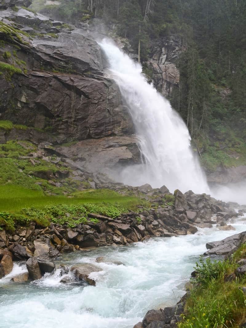
The Krimml Waterfalls can be reached via the Gerlos Strasse, a toll road. It is passable all year round (don’t forget the necessary tyre equipment in winter) and will cost you €12 (motorbikes €8.50) in 2024.
At the Krimmel Falls there is a huge parking lot, an information centre and stalls along the path to the falls. At this link you will find the current opening times and entrance fees.
Hotels High Tauren 😴
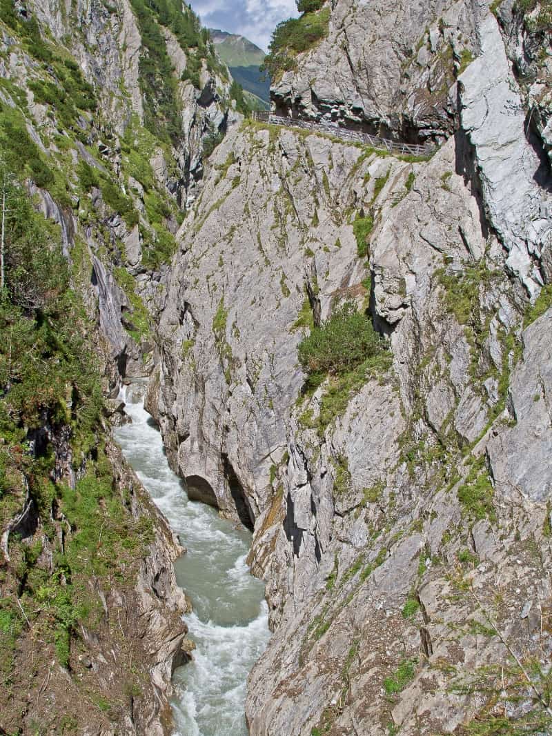
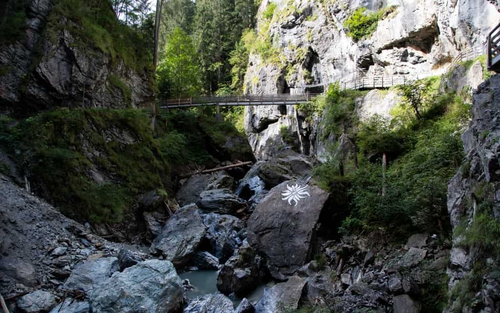
13. Sigmund Thun Klamm
The Sigmund Thun Klamm gorge is located just outside Kaprun. You can park in the large free car park or take the 660 bus directly from Kaprun and Zell am See.
The escarpment was formed over thousands of years by water from melting glaciers that carved its way through the rocks over time. Today, water from the glacier flows through the gorge, creating a series of impressive waterfalls, fast flows and deep pools.
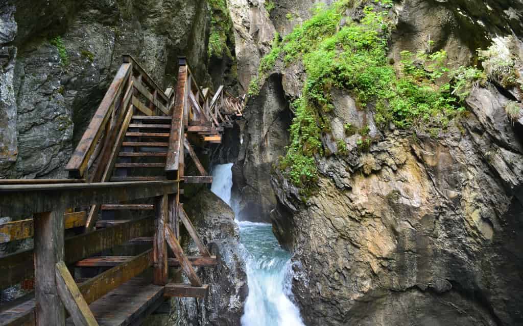
The path through Sigmund-Thun-Klamm is about 320 metres long and leads along wooden footbridges and bridges along steep rock walls.
For up-to-date information on opening times and prices, please visit the official website.
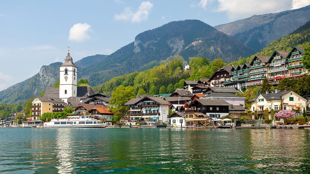
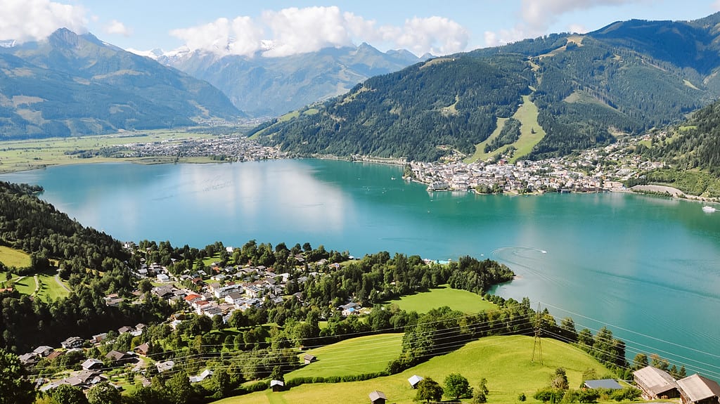
☞ Zell am See is one of the most popular areas to stay in the Austrian Alps. Here is a detailed guide and what to visit around Zell am See.
14. Seebachtal Valley
The Seebachtal valley is located near Mallnitz in the east of the Hohe Tauern. This is a place where you can enjoy both easy and challenging hiking trails. Free parking is available in Seebachtal Alm. From here you can follow the valley to Lake Stappitzer See, where the path is easy, flat and ideal for families with small children.
Alternatively, take the cable car up to the base of the Ankogel, which is reached via a ridge trail with fantastic views of the surrounding area.
It’s not very crowded and the cable car only runs twice an hour, so if you’re looking for a quieter location, this is the place to be. For up-to-date information on the price and opening times of the cable car, please see here.
15. Malta Hochalmstrasse and Kölnbreinsperre Dam
The Malta Hochalmstrasse is one of the most beautiful high mountain roads in Carinthia. It is 14.4 km long and takes you to the Kölnbreinsperre, the highest dam in Austria at 1,902 metres.
Here you can find up-to-date information on opening times and prices for Malta Hochalmstrasse.
There is an easy, wide trail around the dam that leads to the Osnabrücker Hütte mountain hut in the valley behind the dam. The journey to the cottage is about 1.5-2 hours long.
☞ Get inspired by the most beautiful lakes in Austria.
16. Rauristal Valley
The Rauristal Valley is another beautiful valley in the Hohe Tauern, located near the town of Rauris. From Zell am See you are here in half an hour, yet the place comes alive especially in winter and in summer it is quieter than in other places in the Hohe Tauern.
Take a ride up the Hochalmbahnen cable car, enjoy gold panning, the sight of eagles, or hike the ridge trail with spectacular views of the Rauristal Valley. For more information on opening times and prices, click here.
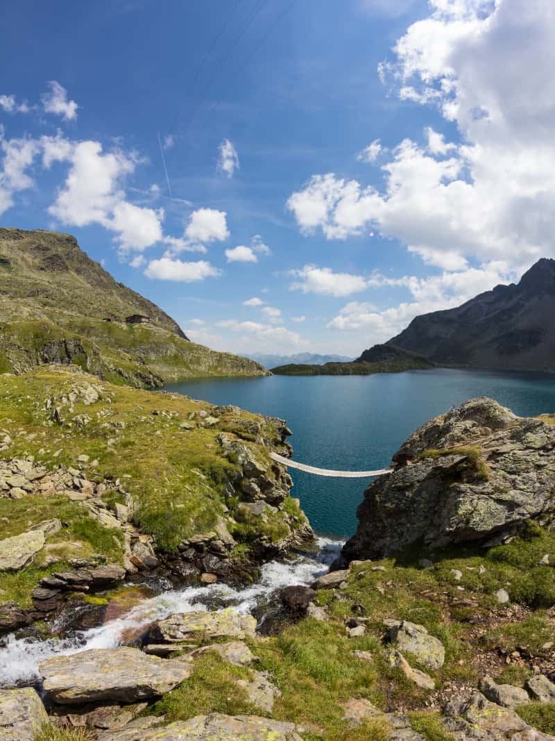
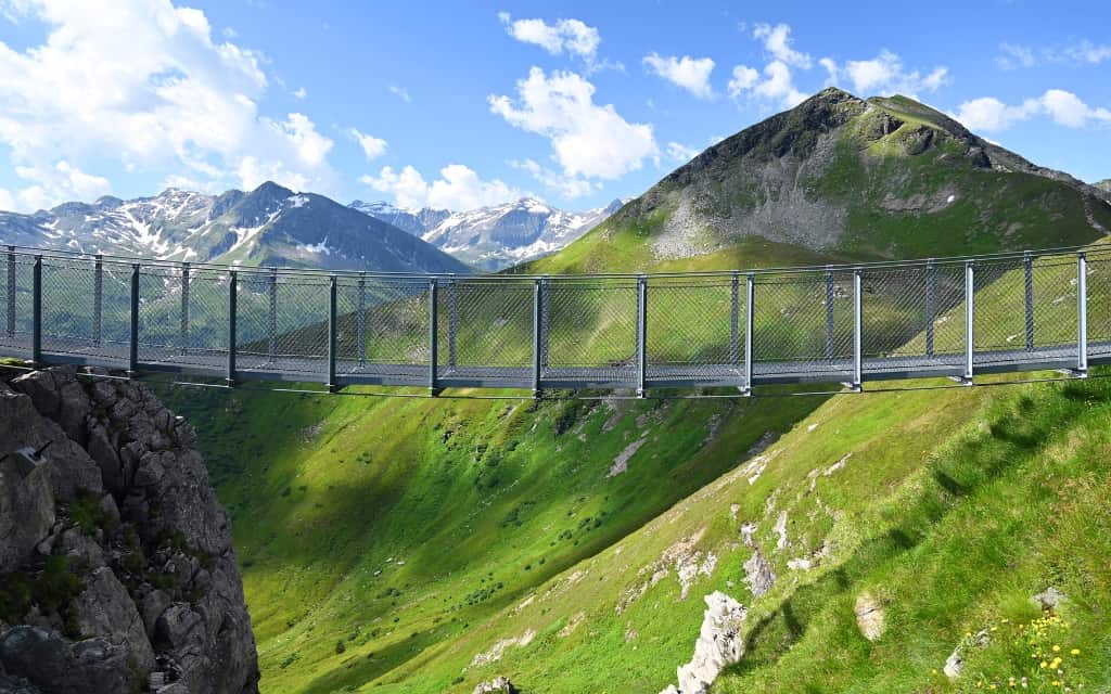
17. Stubnerkogel
Stubnerkogel (2246 m) is one of the most popular peaks in the Hohe Tauern, both in summer and winter. It is close to Bad Gastein and there is a comfortable cable car to the top. You can find more information about the cable car here.
The biggest attraction on Strubnerkogel is the suspension bridge that takes you to the Glocknerblick observation platform, which offers a spectacular view of the Grossglockner, Austria’s highest peak.
18. Kitzlochklamm
The Kitzlochklamm is one of the most beautiful gorges in the Austrian Alps. It goes around the Rauriser Ache river and on the way you can enjoy the view of the crystal clear water from bridges, tunnels and viewpoints. At the beginning of the route you will get a helmet, the route is also suitable for children.
The route starts at the free parking lot at the entrance to the gorge. The Kitzlochklamm is open from the second half of May until the end of October. Click here for up-to-date information on opening times and prices.
19. Sportgastein – things to do in Hohe Tauern
Sportgastein is a ski resort near Bad Gastein that turns into a perfect hiking destination in summer. There are a number of easy trails suitable for children or strollers, as well as challenging day trails.
Sportgastein can be reached via the Gasteiner Alpenstraße, where you have to pay a toll, but it’s definitely worth it. More information on the Gasteiner Alpenstraße can be found here.
There are several shepherd’s huts nearby where you can refresh yourself and buy local products. Head into the green valley surrounded by Alpine peaks or climb to the Bockhartsee lakes (1.5 hours to the upper lake).
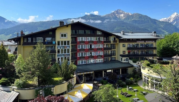
Where to stay in the Hohe Tauern
- Elements Resort Zell am See: Four-star resort with fully equipped apartments, outdoor pool, restaurant, fitness room and free parking.
- AvenidA Mountain Lodges: Stylish aparthotel in Kaprun with complete facilities for a relaxing holiday
- Das Alpenhaus Kaprun: Modern hotel in the centre of Kaprun with spa, swimming pool and half board included
- Hotel LukasMayr: Pleasant three-star hotel in Bruck an der Großglocknerstraße with half board
- Residence AlpenHeart: Cheap hotel in Bad Gastein with Czech speaking staff
- Landgasthof Steiner: Rustic guesthouse in Matrei in Osttirol with half board
Hotels High Tauren 😴
Hiking in Hohe Tauern
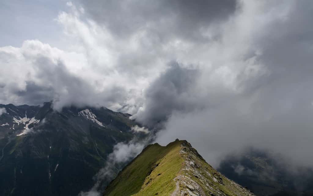
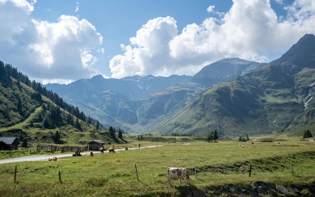
The national park area is crisscrossed with more than 40,000 kilometres of hiking trails. There is a wide range of difficulties, where beginners and experienced hikers who are at home in the high mountain terrain will find their own. You can walk the entire national park along the Tauernhöhenweg, which can be divided into several stages.
Hiking in the Hohe Tauern is very safe. Even in mid-summer you can find snow fields here. Ask in the mountain huts, where they know best what the situation in the mountains is like.
If you are lucky, you will come across horses, cows, sheep, goats, marmots, golden eagles and the rare bearded vulture, which are at home here. With a wingspan of 2.9 m, it is one of the largest birds of the air in the world and the largest bird of prey in Europe.
High Tauern, Austria – map
HOW TO USE THIS MAP: Above you will find a detailed map for the Hohe Tauern in Austria. Click at the top left of the map to see separate layers with highlighted locations. You can hide and show the different layers or click on the icons on the map to see the names of the places I mention in the guide. If you want to save the map, star it. For a larger version, click on the icon in the upper right corner.
Transport in Austria
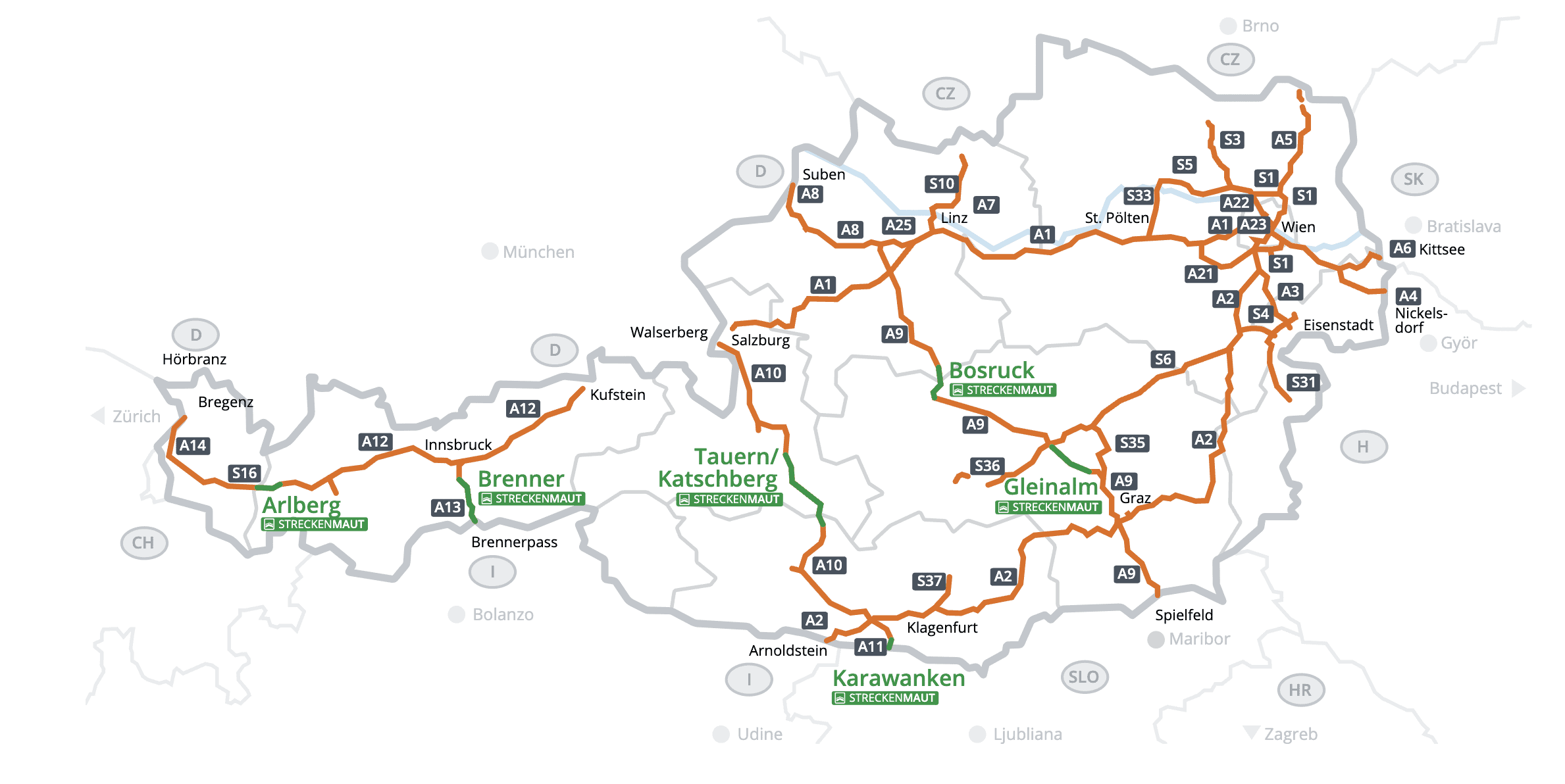
Austrian motorways are toll roads and cost €11.50 for 10 days. You can buy an Austrian vignette here.
Some sections of motorways and tunnels are tolled by section tolls. When travelling from Prague, the A9 Pyhrn – Bosruck Tunnel can be taken for €17 one way. You can pay at the link above, where you can also buy a vignette.
However, it depends on the route, because if you are heading towards Salzburg, you will avoid the Bocruck Tunnel. Here is a map of toll sections in Austria.
The maximum speed limit on Austrian motorways is 130 km/h, 100 km/h on roads and 50 km/h in a municipality like ours. However, there are often speed limits.
When to visit the Hohe Tauern
The best time to visit the Hohe Tauern is June – September.
Most mountain huts at higher altitudes do not open until June. In many places you can also encounter snow fields.
At lower altitudes, some huts and alpine pastures are open from May. In June and July, thunderstorms are more frequent in the afternoon and evening. On the other hand, in July the Alps are beautifully blooming.
The best months for hiking are August and September. If it is warm, you can go to the Hohe Tauern even in October. The national park is literally bursting with colour at this time.
This was our guide to the Hohe Tauern National Park in the Austrian Alps and tips on hikes and hiking trails to visit in the area. Do you have a question? We’ll be happy to answer it in the comments below. Have a safe journey!
More information about the Alps
AUSTRIAN ALPS: See the best places to go in the Austrian Alps, including tips for hikes and walking routes in the area. Tips for the most beautiful places in the Austrian Alps in a separate article..
Or head straight to Tyrol or Lake Wolfgangsee. Other popular destinations in the Austrian Alps are the Dachstein mountain range or the beautiful Lake Achensee.
Zell am See is one of the most popular areas to stay in the Austrian Alps. Here is a detailed guide and what to visit around Zell am See.
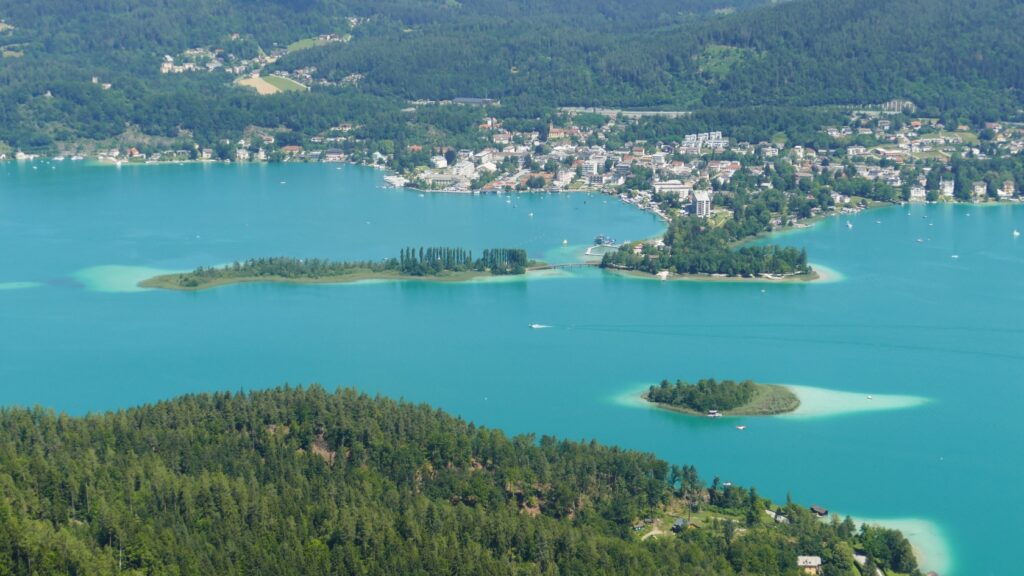
Get inspired by the things to do in Carinthia or enjoy a holiday at one of the lakes in Carinthia. Here is a detailed guide to Lake Wörthersee.
AUSTRIA: Here are the most beautiful places in Austria. Are you planning a visit to the Austrian lakes? Take a look at the most beautiful lakes in Austria.
BAVARIAN ALPS: Get inspired by attractions and hiking tips in the Bavarian Alps.
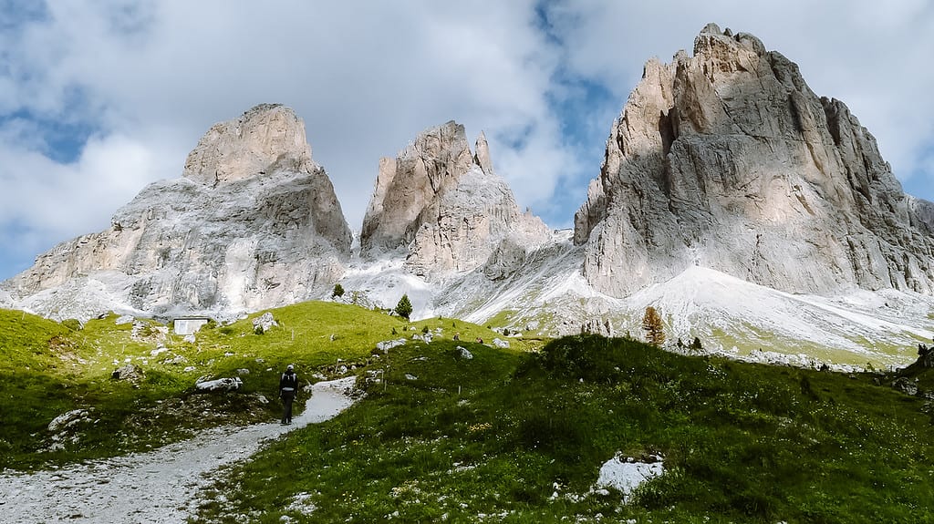
DOLOMITES: We have prepared a detailed guide with tips on the best hikes and hiking routes in the Dolomites.