The Mala Fatra mountain range is one of the most beautiful places in Slovakia. In this guide you will learn what you need for a perfect holiday – things to do in Mala Fatra and tips for the best hikes, where to stay and other useful tips.
Travel guide to Mala Fatra:
- Little Fatra
- Map of National Park Mala Fatra
- Hiking trails
- Accommodation
- Hiking in NP Mala Fatra
- Buses, cable cars
- Transport
Little Fatra
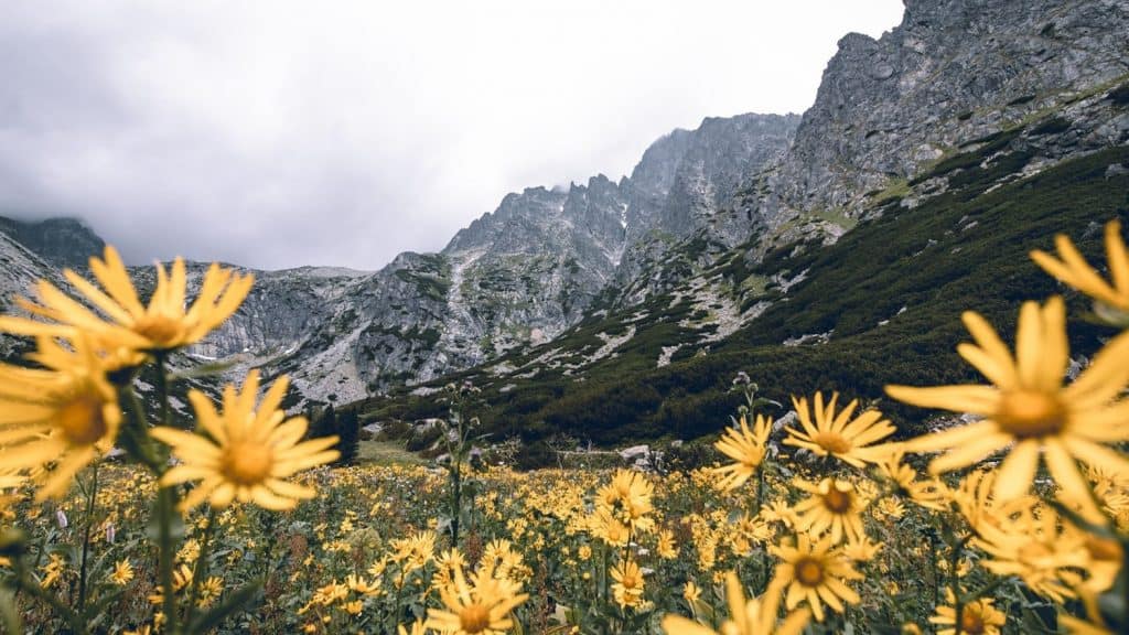
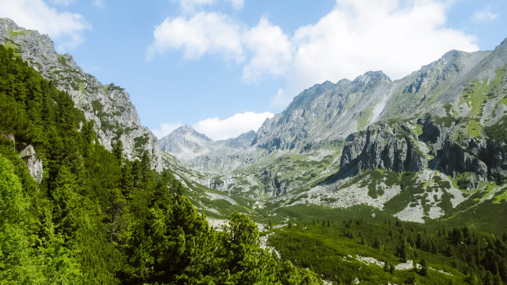
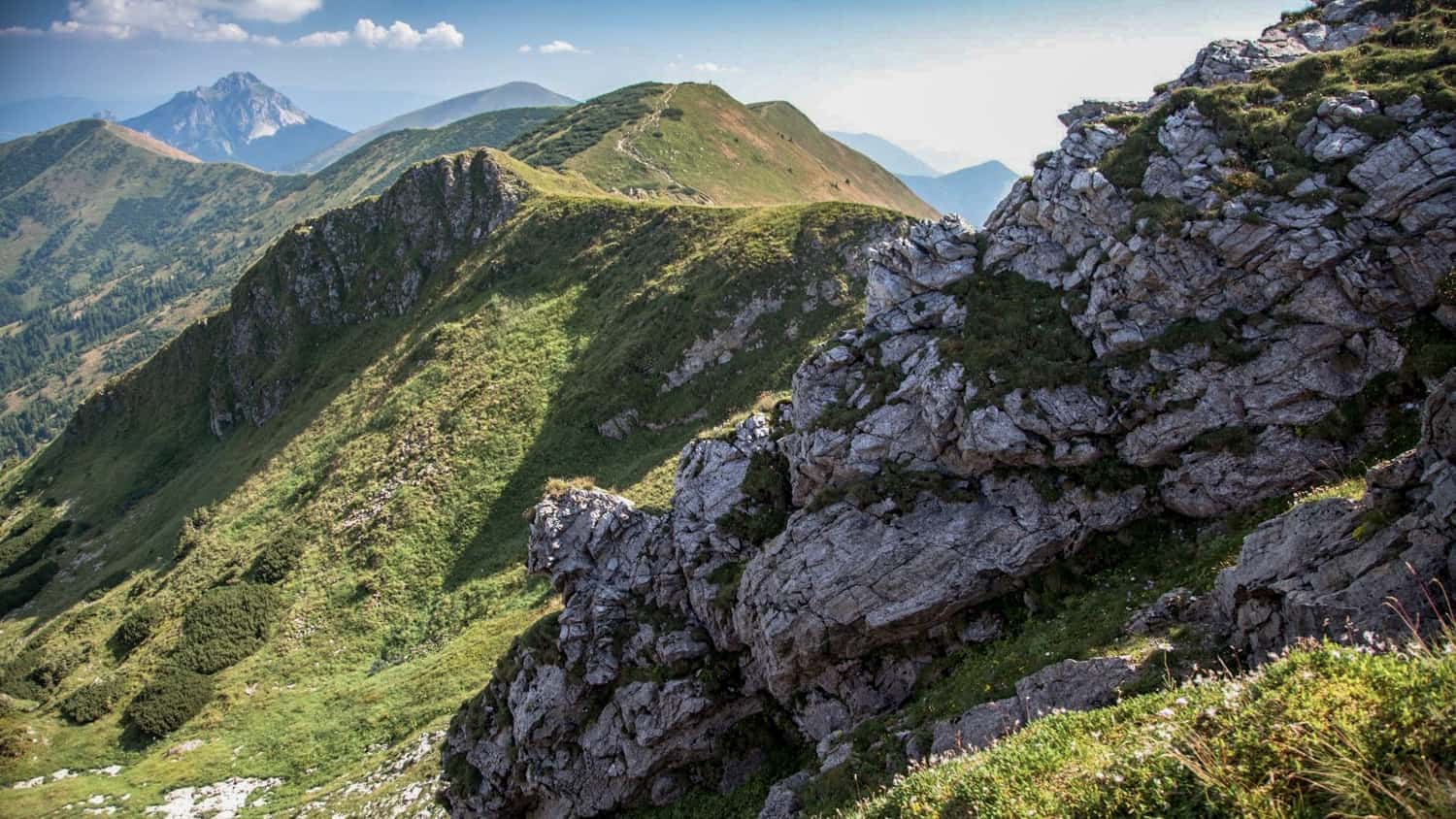
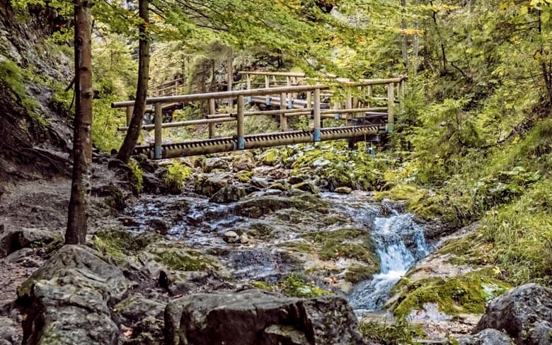
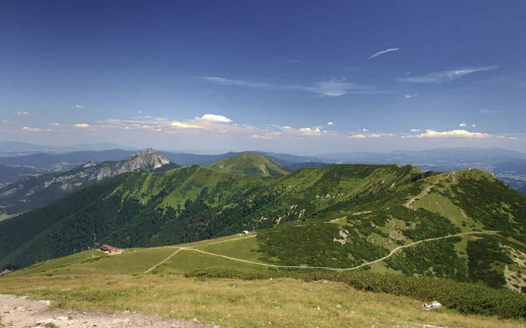
The Mala Fatra mountain range is a place full of beautiful views, rock formations, ravines and gorges, where you can enjoy both easy routes suitable for families with children and high mountain ridge hikes.
Mala Fatra is located in the northwest of Slovakia near Žilina.
The Váh River divides Mala Fatra into two parts: the Kriváňská Mala Fatra, which was declared a national park in 1988, and the larger Lúčanská Mala Fatra. In this guide we will introduce the most popular part – Kriváňská Mala Fatra.
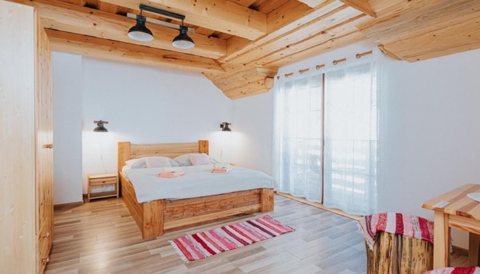
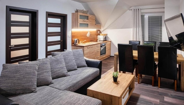
Accommodation in Mala Fatra 😴
Kriváňská Mala Fatra
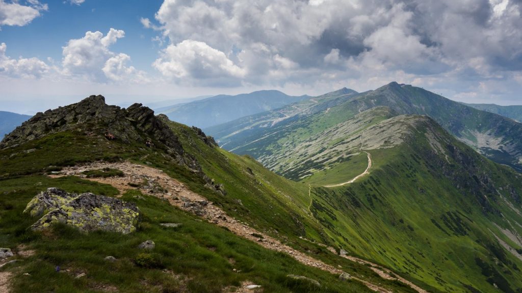
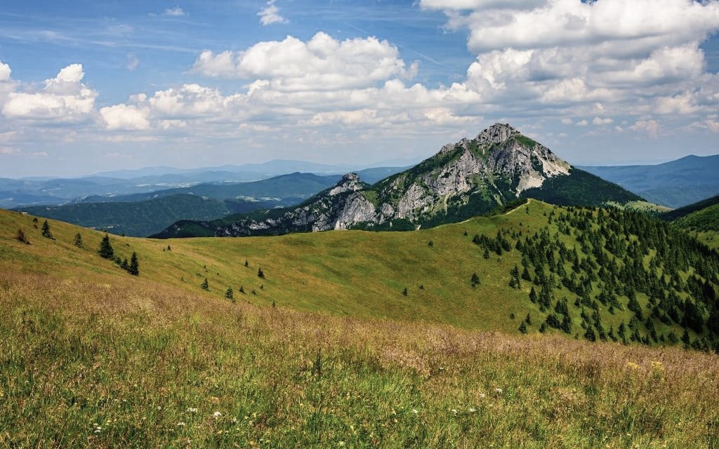
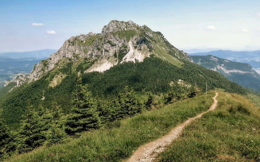
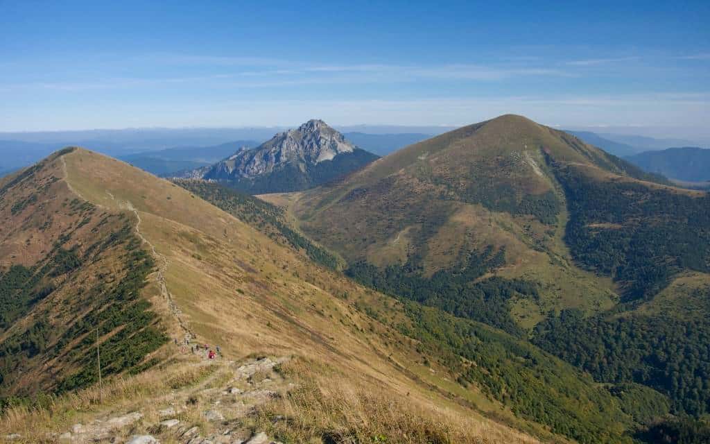
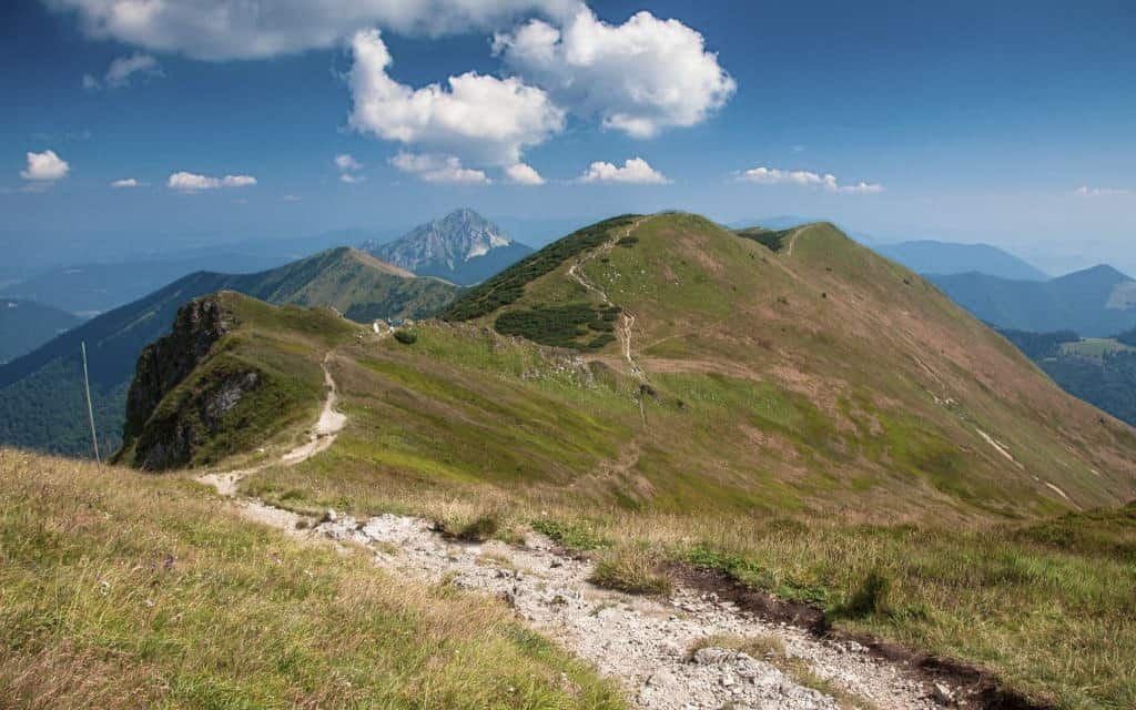
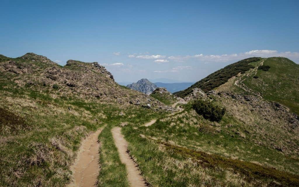
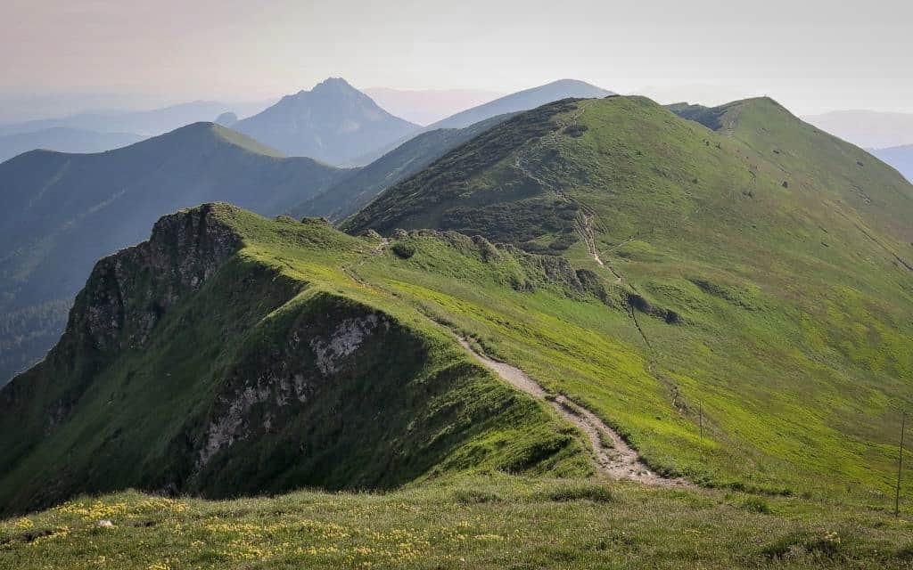
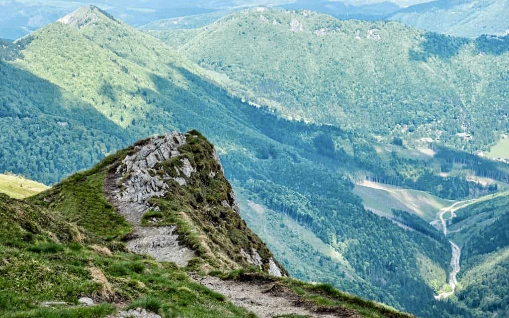
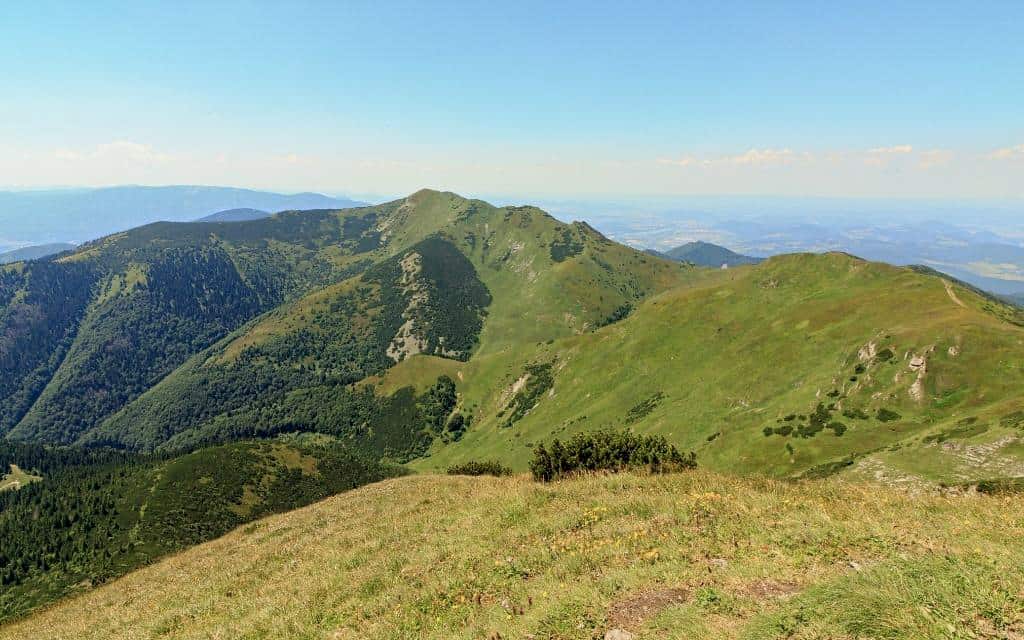
The backbone of Kriváňská Malá Fatra is the ridge route, which consists of the most important and highest peaks of the area, including the highest – Velký Kriváň with a height of 1671 m. The most popular and, according to many, the most beautiful is Veľký Rozsutec (1610 m), which dominates from afar with its peak made of dolomitic limestone.
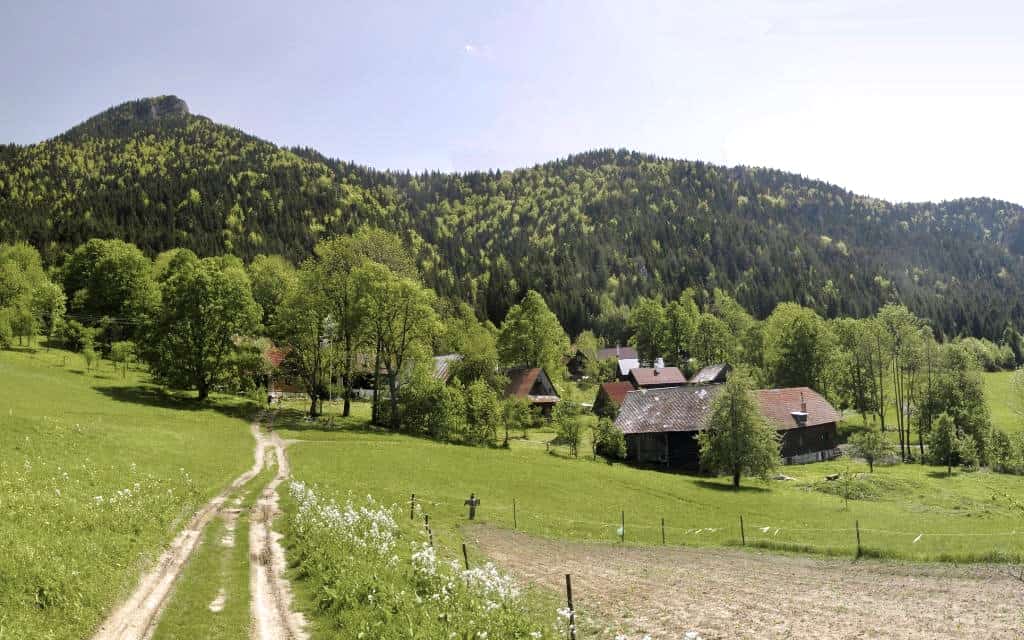
The northern part of the park, where the main resort of Terchová is located, is more popular for tourists and more accessible.
If you are looking for hiking trails where you will often not meet a single animal, start from the south of Malá Fatra. The downside is that the routes from here are sometimes really long with even more elevation gain than if you started from the other side.
Since Kriváňská Mala Fatra is a national park, the rules are stricter. When hiking, you must strictly adhere to marked hiking and biking trails and public roads. Camping is not allowed in the park.
Only bivouacking within 100 m of one of the mountain huts is allowed.
☞ Explore the great value stay packages in Mala Fatra.
National Park Mala Fatra – map
HOW TO USE THIS MAP: Above you will find a detailed map of the Mala Fatra mountain range. Click at the top left of the map to see separate layers with highlighted locations. You can hide and show the different layers or click on the icons on the map to see the names of the places mentioned in the guide about Malá Fatra. If you want to save the map, star it. For a larger version, click on the icon in the upper right corner.
Mala Fatra hikes and hiking trails
1. Janosik’s holes (Jánošíkove diery)
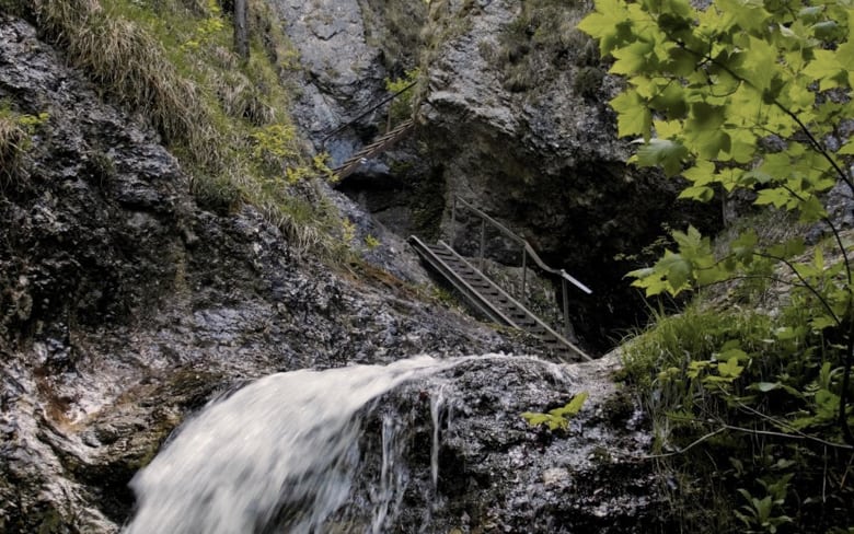
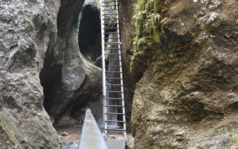
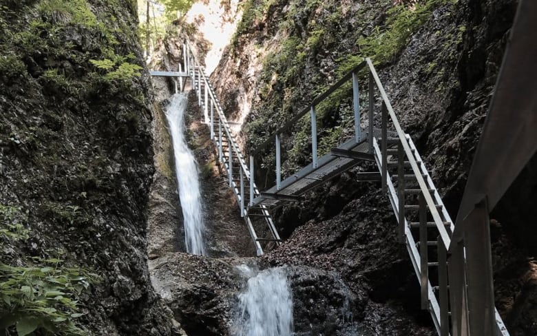
Jánošík’s Holes are a system of gorges created by the flowing Hlboky Brook. It consists of three parts: the Lower Holes, the New Holes and the Upper Holes. Along the way, you will enjoy a beautiful spectacle full of waterfalls and views of the nearby Malý Rozsutec peak.
You can get through the slopes thanks to ladders, footbridges, bridges and chains that make even otherwise inaccessible and very narrow and steep places accessible.
The basic and most visited route is the Nové díry – Dolné díry circuit. The most physically demanding and steepest is the Horné díry gorge, where the turn-off leads. I would not recommend the trip for small children, but the bigger ones can handle the basic circuit without any problems.

There are 2 basic ways to pass through Janosik’s holes:
Circuit over Janošík’s holes from the settlement Biely Potok (Terchová)
- Length of basic circle: 1 h 30 min
- Elevation: ↑ 247 m, ↓ 246 m
- Route map: Janosik Holes basic circuit
- Refreshments: settlement Biely potok, Podžiar cottage
The first circuit starts at Hotel Holes (you can also stay here) in the village of Biely potok, about 3 km from the village of Terchová, where there is a paid parking and a bus stop. From the hotel, follow the blue marked hiking trail along the Hlboky Brook.
After 20 minutes you will come to the Ostrvná signpost, where you turn left to the Nové Diery gorge. You will have a bigger climb and some nice views. Queues can form here in high season, so there is only a one-way route. Through the gorge you will reach the Podžiar hut with several wooden shelters, where you will be treated to a Slovak classic.
From the signpost Podžiar turn right and descend into the Dolné hole gorge. Here you can expect less elevation gain and more waterfalls and rapids as it runs right along the creek. The trail will take you back to the beginning of the trail to the Ostrvná signpost and to the settlement of Biely potok.

If you have 1.5 hours of extra time, turn left at the Podžiar hut on the blue trail uphill and head through the Horné hole gorge. It is more physically demanding because it is the wildest gorge of the Janosik holes. But it is also the most beautiful.
The journey through the gorge takes about 45 minutes to the signpost Pod Pálenicou, where you can turn steeply down the green hiking trail and descend back to the signpost Vrchpodžiar, from where you can see the Podžiar hut. In early spring or after heavy rains, the Upper Hole Gorge may be closed due to the danger of high water.
Circuit over Janošík’s holes from Štefanová
- Length of the circuit through Dolné díry and Nové díry: 1 h 50 min; length of the circuit through Horné díry: 2 h
- Elevation: ↑ 357 m, ↓ 357 m
- Route map: Janosikove diery from Štefanová; Horné diery from Štefanová
- Refreshments: settlement Štefanová, Podžiar cottage
The second route starts in the village of Štefanová, where there is again a paid parking lot. Pass through the settlement and continue in the direction of Jánošík’s holes to the signpost and the Podžiar hut. Here you can choose a circuit through Horné díry to the right uphill (2 h) or a basic circuit through Dolné díry and then Nové díry (1.5 h), or go through all 3 gorges.
2. Malý Rozsutec (1344 m)
- Length: 4 h 30 min; moderate hike
- Elevation: ↑ 859 m, ↓ 859 m
- Route map: Ascent to Malý Rozsutec
- Refreshments: settlement Biely potok, Podžiar cottage, well at the saddle Medzirozsutce
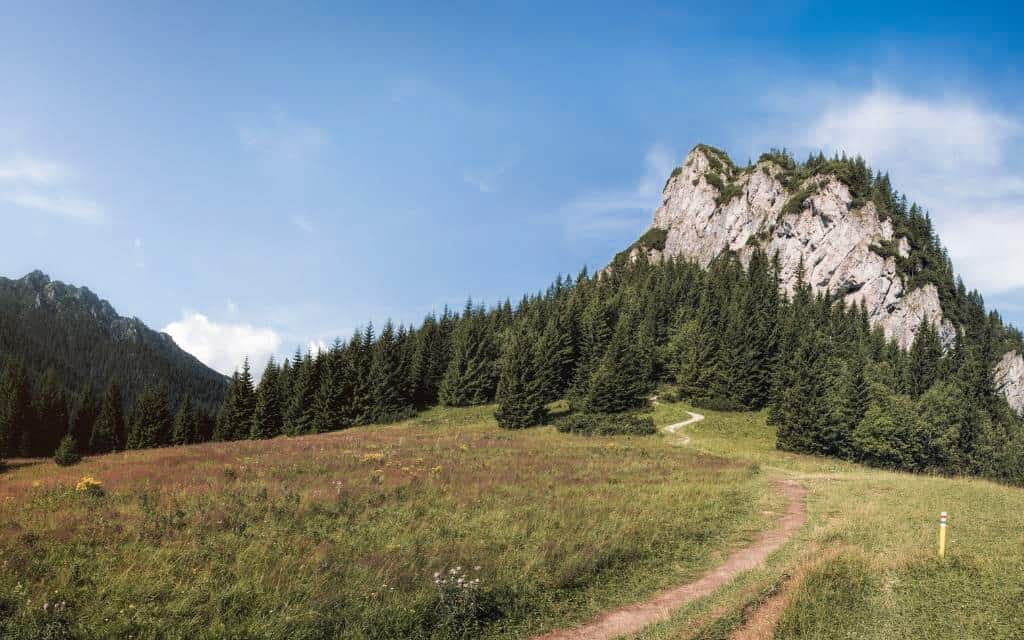
Malý Rozsutec is a dolomitic peak towering above the Jánošík holes, where our ascent begins. Park your car in the village of Biely potok, from where you will go through Jánošík’s Holes – first through the New Holes gorge and then uphill from the Podžiar signpost through the Horní díry gorge.
The Horné hole trail will take you to the signpost Pod Tanečnicou, from where you will have Malý Rozsutec in sight. The meadow ascends gently to the saddle of Medzirozsutec and the saddle of Zákres, from where a short and steep ascent leads to the summit, which is protected by chains.
When you have enjoyed the views of Orava, Vrátná dolina and Kysuce, continue along the rocky ridge with chains and descend steeply through the forest to the settlement Podrozsutec and back to the settlement Biely potok.
☞ Explore the great value stay packages in Mala Fatra.
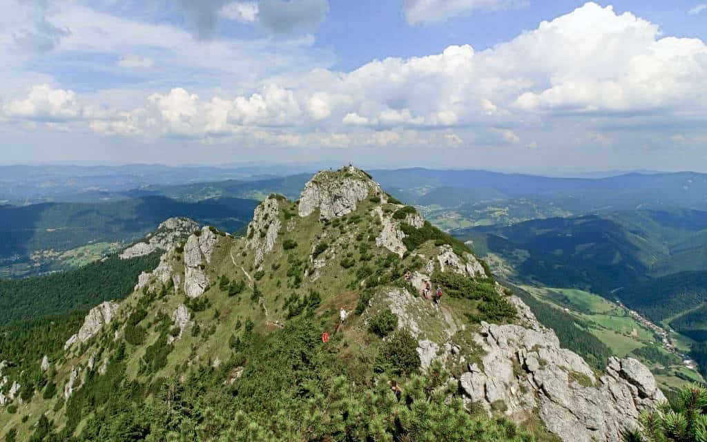
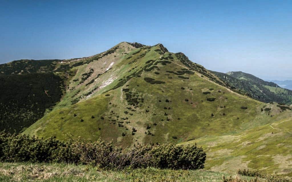
3. Veľký Rozsutec (1610m)
We are going to the king of Mala Fatra and one of the most beautiful peaks in Slovakia. Like Malý Rozsutec, the peak of Veľký Rozsutec is made of dolomitic limestone. Both peaks are thus out of the ordinary form of other peaks in Malá Fatra.
- Length: 5 h 15 min; all-day challenging hike with high altitude
- Elevation: ↑ 1080 m, ↓ 1080 m
- Route map: Ascent to Veľký Rozsutec
- Refreshments: Štefanová, koliba Podžiar, wells at the saddle Medzirozsutce and saddle Medziholie
We start in Štefanová, from where we start in the direction of Jánošík’s Holes and the Horné Diery Gorge, or turn a little earlier at the Vrchpodžiar signpost to the right along the green trail, if you don’t want to linger on the way over the ladders. Climb up the gorge to the signpost Pod Tanečnicou.
On the left side there is the beautiful Little Rozsutec. Continue through the meadow to the saddle of Medzirozsutec, where you turn right along the red ridge trail towards Veľký Rozsutec.
There are still 400 metres to go to the top, from where you can enjoy the Kysuce, Orava and Kriváňská Malá Fatra. In good visibility you can see up to the Tatras.
From the summit, continue along the sheltered path and then through the forest and meadow to the Medziholie saddle, where you turn right on the green trail. On the way down you will have a great view of the Vrátná dolina valley and gradually descend back to Štefanová.
4. Malý Rozsutec – Veľký Rozsutec
- Length: 6 h 20 min; all-day challenging hike with high altitude
- Elevation: ↑ 1253 m, ↓ 1253 m
- Route map: Ascent to Veľký and Malý Rozsutec
- Refreshments: settlement Biely potok, Podžiar cottage, well at the saddle Medzirozsutce
Do you have the strength and feel up to both peaks in one day hike? You can expect a challenging climb, but also a beautiful ridge route.
The route is the same as the route to Malý Rozsutec. You will start from the village of Biely potok through Nové and Horné díry to the saddle of Medzirozsutec, from where you will go right to Veľký Rozsutec. The round trip to the top will take you about 2.5 hours. After you return from Veľký Rozsutec back to the saddle of Medzirozsutec, you continue to Malý Rozsutec and from there through the settlement of Podrozsutec back to the settlement of Biely potok.
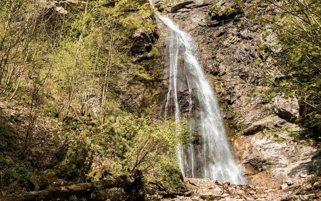
5. Šutov Waterfall
The Šútovský waterfall is one of the highest waterfalls in Slovakia and the highest in Malá Fatra with its 38 metres.
- Length one way: 1 h 45 min; easy route
- Elevation: ↑ 367 m
- Route map: Route to Šutov Waterfall
- Refreshments: settlement Rieka, chata Vodopád
The route to the waterfall starts behind the village of Šútovo in the Rieka settlement, where there is a parking lot, refreshments and a playground. In summer, you can even swim in the former quarry of the Lake Kraľovanské From the settlement you continue into the national park past the Fafranka hut (open in season) along the blue hiking trail along the Šútovský brook.
The path leads from the beginning along the asphalt road and then at the Waterfall Cottage it turns into a comfortable wide path, which you climb gently up to the signpost with a turn-off to the Šútovský waterfall.
You return to the signpost and from there you can either go back through the Šútovská valley to the village of Rieka or continue up the steep climb past the Mojžíš springs to the Chata pod Chlebom. On this section you will climb up to 700 vertical metres, so the route suddenly turns into a full-day challenging route with a big elevation gain.
You can return from the chalet by a circular route along the green trail, which leads steeply down the slope and then through the forest along the Révajovská valley.
Accommodation in Mala Fatra 😴
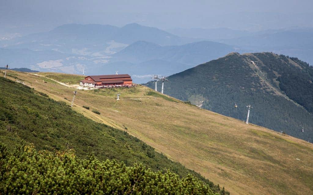
6. Cottage on the Grun
Are you looking for an easy trip that even smaller children can handle? Cottage na Grúni is an ideal place where you can go all year round. You can eat here, stay here, children can have fun on the playground, and in winter you can ski.
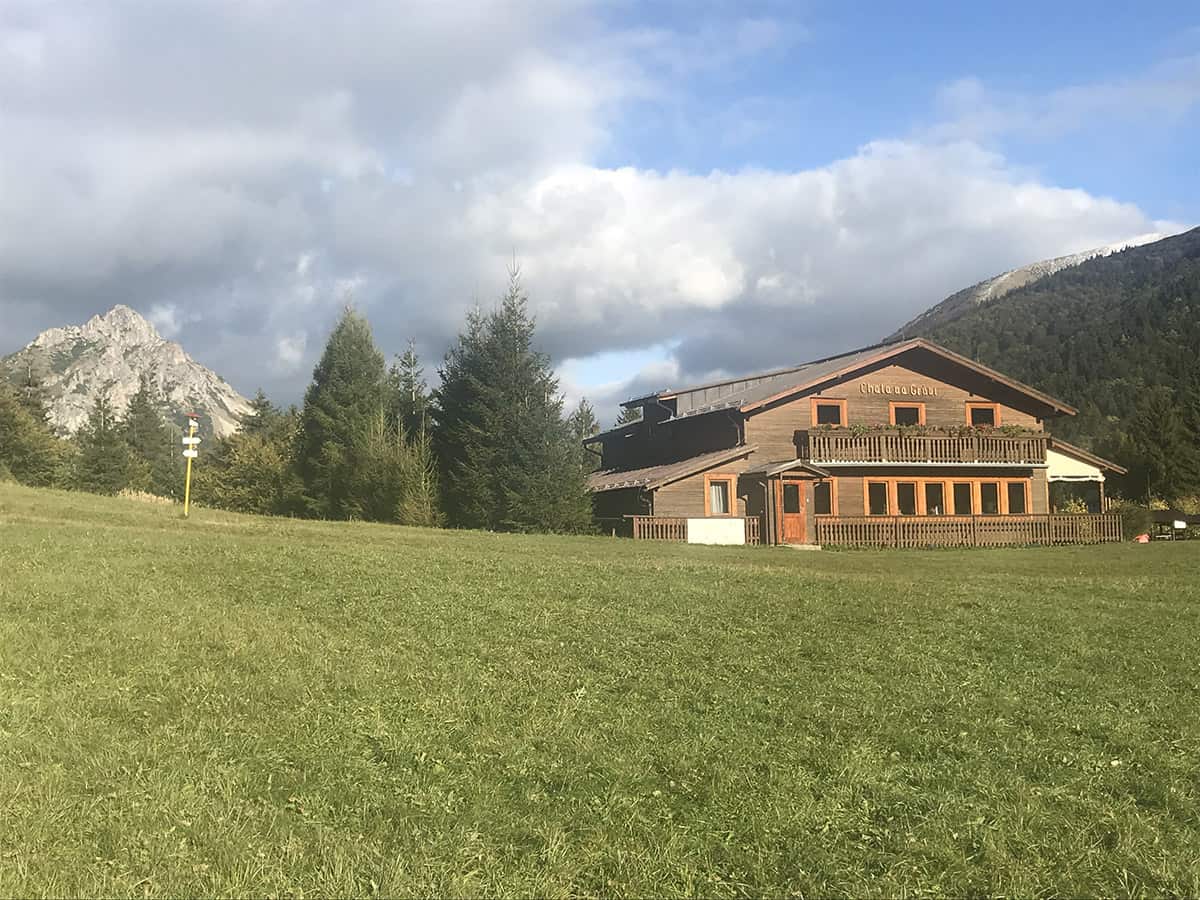
The cottage can be reached in three directions. All routes are easy:
- Route from the lower station of the cable car in Suchá dolina along the yellow trail – 45 minutes; elevation 239 m; several gravel parking areas, but usually full early in the season; bus stop Vrátná-Výtah
- Route from Starý dvůr along the blue trail – 1h 15 min; elevation 360 m; large free parking; bus stop Vrátná-Starý dvor
- Route from Štefanová along the blue trail – 1 h; elevation 358 m; large paid parking for 3 € for the whole day; bus stop Vrátná-Štefanová
From Chata na Grúni you can continue along the yellow hiking trail to the top of Poludňový grúň (1460 m), which lies directly on the ridge trail.
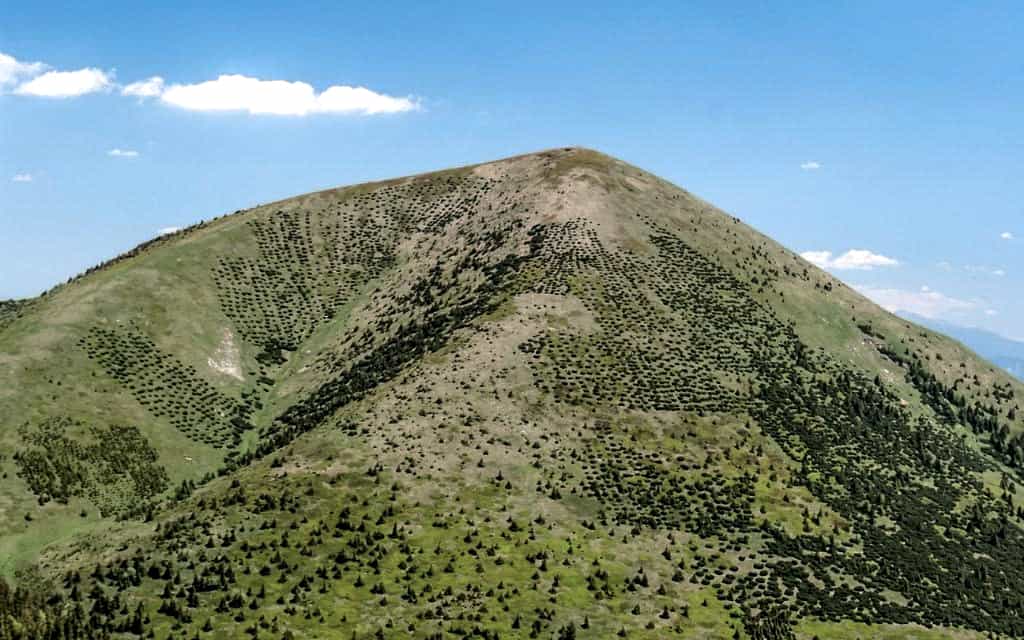
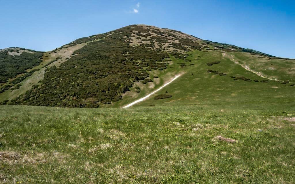
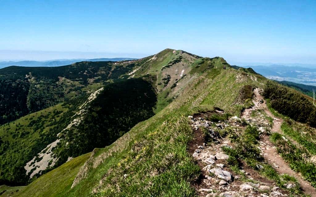
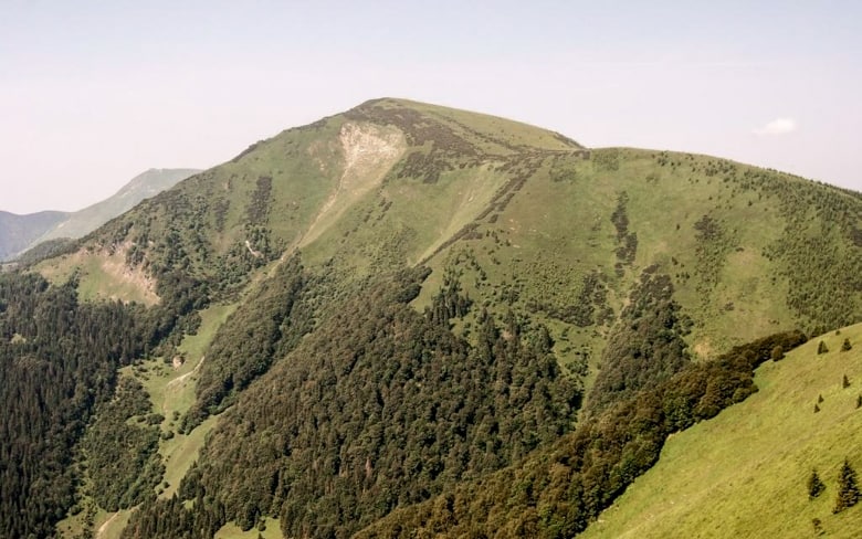
7. Stoh (1607 m)
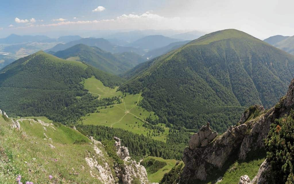
Stoh is the next peak on the ridge, which follows right after Veľký Rozsutec. Unlike it, however, it is significantly flatter, not rocky and wooded, so you can enjoy a panoramic view not only of Veľký Rozsutec, but also Poludný grúň and other peaks in Kriváňská Malá Fatra.
- Length: 5 h 15 min; all-day challenging hike with high altitude
- Elevation: ↑ 1193 m, ↓ 1193m
- Route map: Štefanová – Chata na Grúni – Stoh
- Refreshments: Štefanová, Chata na Grúni, well in the saddle Medziholie
The route starts in the village of Štefanová, where you can park in a large paid parking lot or take a bus from Terchová. After the car park, turn right (left to reach Janosik’s holes) and continue along the paved road to the Vyhnanej Cottage, where the road turns gravelly after the barrier.
Continue through the forest to the Cottage na Grúni. From here you will start climbing up the yellow trail to the top of Poludňový grúň (1460 m). Once you get to the top, the worst of the climb is behind you. Turn left along the ridge trail towards the peak of Stoh, which is in sight, followed by Veľký Rozsutec.
From Stoh you continue on to the Medziholie saddle, where there is a well with drinking water, and gradually descend back to Štefanová along the green trail.
The route can also be walked in the opposite direction if you want to eat in the Cottage na Grúni towards the end. In terms of time and climb it will be almost the same.
☞ Explore half-board packages in Mala Fatra.
8. Bread (1646 m)
Chleb is one of the most prominent peaks on the main ridge route in Kriváňská Malá Fatra. Thanks to the cableway to the Snilovský sedlo, it is easily accessible, so it is also frequently visited.
Length of the circuit via Chata pod Chlebom: 1 h 45 min; easy hike through mountain terrain
Elevation: ↑ 323 m, ↓ 323 m
Route map: Ascent to Chleb and to the Chalet pod Chlebom
Refreshments: upper and lower cable car station, Chata pod Chlebom
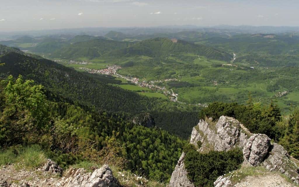
The starting point is again the Vrátná valley, where you can get off at the lift stop or park in the free parking lot (in high season it is often crowded). The cable car will shorten your journey by more than 750 metres to Snilovský sedlo, where you will turn left along the red marked ridge trail to the top of Chleb (1646 m).
In half an hour you are at the top with a beautiful view of the Little Fatra and its surroundings. From here you continue over the top of Hromová to the saddle behind Hromová.
If you don’t have enough time, turn right on the yellow trail and follow the signs to Chata pod Chlebom, the highest and most popular chalet in Mala Fatra. You go around the Chleb peak and down the slope to the Snilovský saddle, from where you take the cable car down to the Vrátná valley or run down the green (about 45 minutes of steep descent).
If you have more time, I recommend to go from the saddle behind Hromov further over the two-peaked Steny mountain, where you will see Stoh on your right and Veľký Rozsutec slightly to the left.
This part of the route belongs to the most popular part of the ridge in Malá Fatra. You won’t get too busy here and the views are awesome.
You can go back the same way or you can descend steeply through Poludňový grúň to the Cottage na Grúni and from there back to Vrátná dolina.
9. Veľký Kriváň (1709 m)
The highest peak of Malá Fatra Veľký Kriváň cannot be missed here. Veľký Kriváň is situated directly on the main ridge route and an easy trail leads to it from Snilovský sedlo.
Length: circuit 2 h 15 min; 1 h only Veľký Kriváň there and back from the cable car; easy hike through mountain terrain
Elevation: ↑ 382 m, ↓ 382 m
Route map: Ascent to Veľký Kriváň
Refreshments: upper and lower cable car stations
We start in Vrátná valley, where you can leave your car or take a bus (stop Vrátná-Výtah). Take the cable car up and climb gently up to the Snilovský sedlo, from where the highest peak is in sight on your right.
Follow the red hiking sign and after about 20 minutes you will come to a signpost where you turn perpendicularly left and start a steeper climb to the top. In good visibility you can see all the way to Moravia and Silesia in Czech Republic.
You will then return to the signpost again. Here you can return like most people back to the cable car, taking a total of 1 hour. The other option is to continue along the ridge trail to the top of Pekelník (1609 m) and see the less accessible places. At the Buben saddle, turn right on the yellow trail and descend to the Chrapáky signpost, where you turn right on the blue side of the main ridge back to the upper cable car station.
If you have enough time, you can extend the route to Malý Kriváň or to the Chalet pod Suchým, where you will spend the night and return the next day.
10. Cottage under Suchy
Length in one direction: 2 h 45 min; moderately difficult route
Elevation: ↑ 734 m, ↓ 31 m
Route map: Ascent to the Chalet pod Suchým
Refreshments: Nezbudská Lúčka, Chata pod Suchým
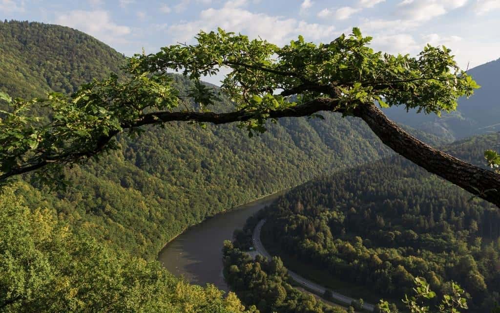
Chata pod Suchým is a popular mountain chalet at the end of the main ridge route. You can get here from the village of Strečno-Nezbudská Lúčka along the red marked tourist trail. Most of the way you go through the forest, but there are a few viewpoints on the meander of the Váh River.
From the hut you can continue steeply up the ridge to the peak of Suchý, which is the first peak of the main ridge route in Malá Fatra. You will enjoy a beautiful view from it.
You can spend the night at the hut and the next day continue along the trail over the Suchý peak to the peaks of Malý Kriváň, Veľký Kriváň, Chleb, or. extend the route with an overnight stay in other mountain huts nearby (Chata pod Chlebom, Chata na Grúni) up to Veľký and Malý Rozsutec, from where you return by bus.
11. Little Krivan
Malý Kriváň is the second highest peak of Malá Fatra, offering perhaps even better views than Veľký Kriváň. In addition, far fewer tourists come here because it is not so easily accessible.
Length in one direction: 1 h 45 min; easy hike through mountain terrain
Elevation: ↑ 454 m, ↓ 295 m
Route map: Ascent to Malý Kriváň
Refreshments: upper and lower cable car stations
The most beautiful route to Malý Kriváň leads from Snilovský sedlo, which can be reached by cable car from Vrátná dolina (bus stop Vrátná-Výtah or free parking). Head to the right along the red marked hiking trail.
After about 20 minutes you can turn off to Veľký Kriváň, then return to the signpost and continue on through Pekelník to Malý Kriváň.
From Malý Kriváň you have several options to get down. For example, take the blue trail down to Krasňany, from where you can take a bus to wherever you need to go.
12. Baraniarky – Kraviarske
The peaks of Baraniarka and Kraviarska form a side ridge to the main ridge in Kriváňská Malá Fatra. Thanks to this, there are far fewer tourists, but the views from here are as breathtaking as from the main ridge.
Length: 3 h 40 min; moderate hike
Elevation: ↑ 862 m, ↓ 772 m
Route map: Route Braniarky – Kraviarske
Refreshments: the Old Court
The starting point is Starý dvor (a large free parking lot or the Vrátná-Starý dvor stop). At the main car park, turn right along the asphalt road, from which you will turn left at a sharp left turn after about 10 minutes and climb through the forest to the Príslop saddle, which is unforested and offers beautiful views of Veľký Rozsutec.
You continue along the blue trail and enter the forest again until you reach the top of Baraniarka (1270 m), from which you can enjoy the view of Mala Fatra. You continue along the ridge, over the wooded peak of Žitná, where after a while the forest cover fades and along the ridge you can enjoy views in both directions up to Kraviarske (1361 m).
At the saddle behind Kraviarsky you disconnect from the blue and descend back to Vrátná dolina on the green, where you can ride one stop back to Starý dvůr or walk down around the road.
13. Sokolie (1171 m)
The top of Sokolie is a rocky ridge with a beautiful view of the main ridge.
Length: 2 h 45 min; moderate hike
Elevation: ↑ 575 m, ↓ 575 m
Route map: Ascent to Sokolie
Refreshments: Old Court
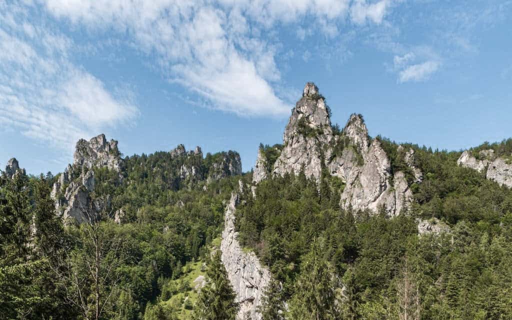
The route up to the Príslop saddle is identical as in the case of the side ridge Baraniarka – Kraviarska (see previous point). In the saddle, you will leave the blue hiking trail and follow the yellow trail, which will take you through the Tiesňavy National Park and the rock formations around the Sokolie peak.
You can get back to Stary Dvor from the Sokolie, Ridge signpost, where you follow the green hiking trail.
Note: Go to Sokolie in dry weather. The road is chained in places and is not safe after rain or in winter.
14. Osnica (1363 m)
Osnica is one of the peaks that few people think of at first sight when visiting Mala Fatra. This is a great pity, because the views of Veľký Rozsutec and Stoh are great.

Length in one direction: 2 h 30 min; moderate hike
Elevation: ↑ 758 m, ↓ 34 m
Route map: Ascent to Osnice
Refreshments: Štefanová, springs in the saddle Medziholie and at the saddle Osnice
Osnice can be reached from Štefanová by following the green hiking trail, which will take you up to the Medziholie saddle in an hour, where you will turn from green to blue in the direction of the Osnice saddle. The worst of the climb is behind you and you just climb slowly to the top (about 45 minutes from the Medziholie saddle).
15. Statue of Juraj Janosik
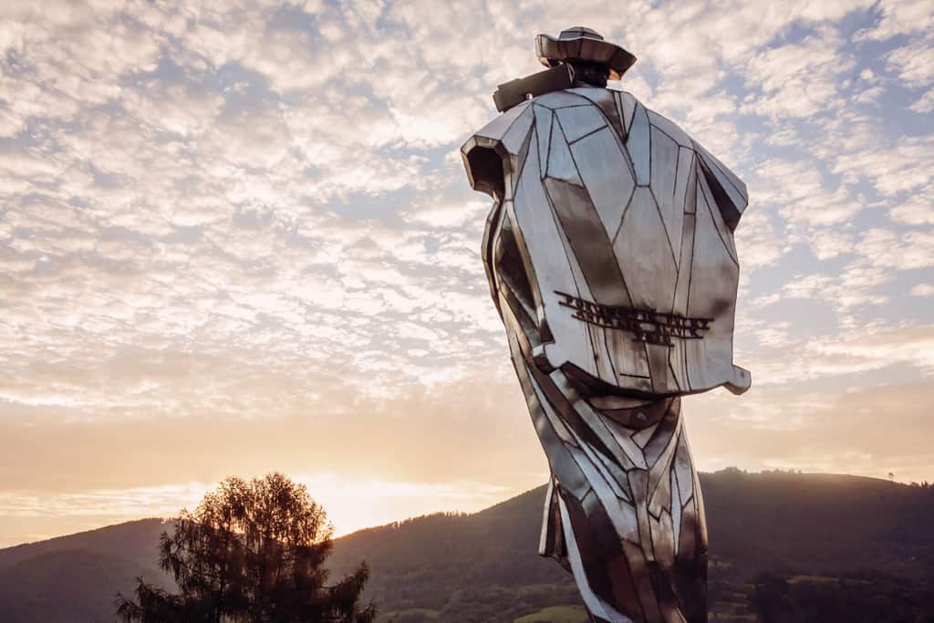
Juraj Janosik was a bandit and Slovak national hero who was born in Terchova. It is here that a monumental stainless steel statue, unveiled on the 300th anniversary of his death, rises on the hill. Its task is to guard the entrance to the Vrátná valley. The statue is easily accessible from the information centre directly from the village of Terchová.
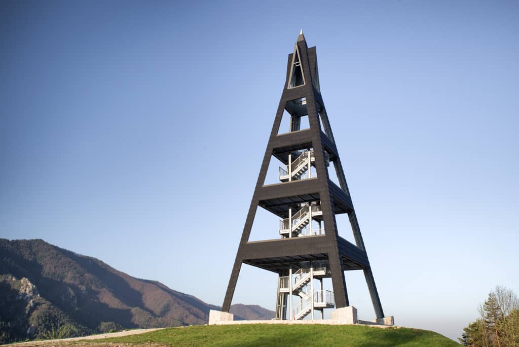
16. Terchovské srdce lookout tower
The popular lookout tower Terchovské srdce is located above Terchova, so from here you will have the whole village in the palm of your hand, but also the Little Fatra behind it. There is a short trail leading directly from the village, which can be managed even by smaller children. The car park is located just behind Lidl. From here, head uphill on the blue/green hiking trail. There are also refreshments and a big red heart at the lookout tower.
- Length: 15 min
- Route map: Route to the Terchov Heart lookout tower
Accommodation
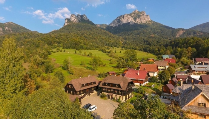
If you are coming to Malá Fatra for the first time and want to see the best, I recommend to choose accommodation in Terchová or somewhere nearby. Terchová is the main resort, from where you will have a short walk to many trips and routes. Moreover, it is very well connected with Žilina and Malá Fatra by buses.
- Pension Sagan: Family-run guesthouse with excellent cuisine and a starting point for hiking in Malá Fatra
- Hotel Holes: A popular 3* hotel right at the entrance to the Janosik Holes
- Pension Natália: Cozy accommodation with excellent facilities and shared kitchen in Terchova
- Apartments Janosik: Modern rooms and apartments + breakfast included
Accommodation in Mala Fatra 😴
Hiking in Kriváňská Malá Fatra
Mala Fatra is an ideal place for hiking all year round. You can go here even in winter and enjoy the mountains wrapped under a white blanket.
In the national park you have to stick to the strictly marked trails, but they can sometimes be dangerous in the snow. For example, the route over the top of Stoh leads over slopes where avalanches are often a risk. That is why some routes are marked with poles in winter.
So if you see a pole sign in winter, stick to it to stay safe. Don’t forget to pack crampons and hiking poles, which will make walking in the snow or icy places much safer.
Sticking to the trails is also important for another reason – the likelihood of encountering a bear is greatly reduced. Bears are shy. As soon as they see or hear people, they withdraw themselves. That’s why it’s good to make a little noise – talk, step on twigs in the forest, etc.
If you see a bear, back off. Slowly, so you don’t provoke him. If the bear is too close, you can try climbing a tree or curling up on the ground with your hands behind your neck and playing dead. The bear will leave after a while.
The weather is very variable in the Little Fatra Mountains. Before you go, check the weather and make sure there is no risk of thunderstorms. Some places are quite remote and it takes several hours to get back to civilization (Veľký Rozsutec, Malý Kriváň and others). One of the most accurate weather apps is the Windy app and website. Get up and get going early in the morning when the weather is more stable. Thunderstorms are more frequent in the afternoon.
One last tip – take cash so you can grab a bite to eat on the way at one of the mountain huts. You can fill up water in the wells that are scattered throughout the national park.
☞ Explore the great value stay packages in Mala Fatra.
Transport in Mala Fatra (buses, cable cars)
Entry to Kriváňská Mala Fatra is forbidden with few exceptions. However, there are regular bus services which are reinforced in the high season. The most popular starting points for hiking include:
- Lower station of the cable car at the Vrátná chalet in the Suchá dolina (starting point for Chleb, Veľký Kriváň, Malý Kriváň, Chata pod Chlebom) – there are several gravel parking areas, but they are full early in the season; bus stop Vrátná-Výtah
- Starý dvor in Vrátná valley (starting point for Baraniarky, Kraviarske, Sokolie, Chata na Grúni) – large free parking; bus stop Vrátná-Starý dvor
- Settlement Štefanová in Nová dolina (starting point for Jánošík’s holes, Veľký Rozsutec, Stoh, Osnica) – large paid parking for 3 € for the whole day; bus stop Vrátná-Štefanová
- Settlement Biely potok (starting point for Jánošíkove holery, Malý Rozsutec) – paid parking for 5 € for the whole day; bus stop Terchová-Biely potok
You can find the specific bus connection on the Slovak timetables or here:

Accommodation in Mala Fatra 😴
Transport to Mala Fatra
Mala Fatra by car
Mala Fatra is very easily accessible. It is located near Žilina and can be reached comfortably by motorway.
A motorway vignette in Slovakia will cost you €12/10 days or €17/30 days. You can buy it easily online. Fuel prices can be viewed at this link.
Mala Fatra by train
You can get to Mala Fatra by train Prague-Košice. The journey from Prague takes 5.5-6 hours and for a one-way trip you can pay between CZK 300-450 depending on the departure time . You will get off in Žilina or Vrútky, depending on where you are staying. In Žilina, if you are heading to the northern side of Mala Fatra and in Vrútky, if you have accommodation in the south of the mountains.
The centre of Mala Fatra is Terchová. You can get here in 45 minutes by bus from Žilina. A ticket will set you back €1.95 (2023) and the bus station is right in front of the train station. For current connections, see the Slovak timetables.
These were our tips for trips and the most beautiful places to visit in Malá Fatra. Do you have a question? We’ll be happy to answer it in the comments below. Have a safe journey!
More information about Slovakia
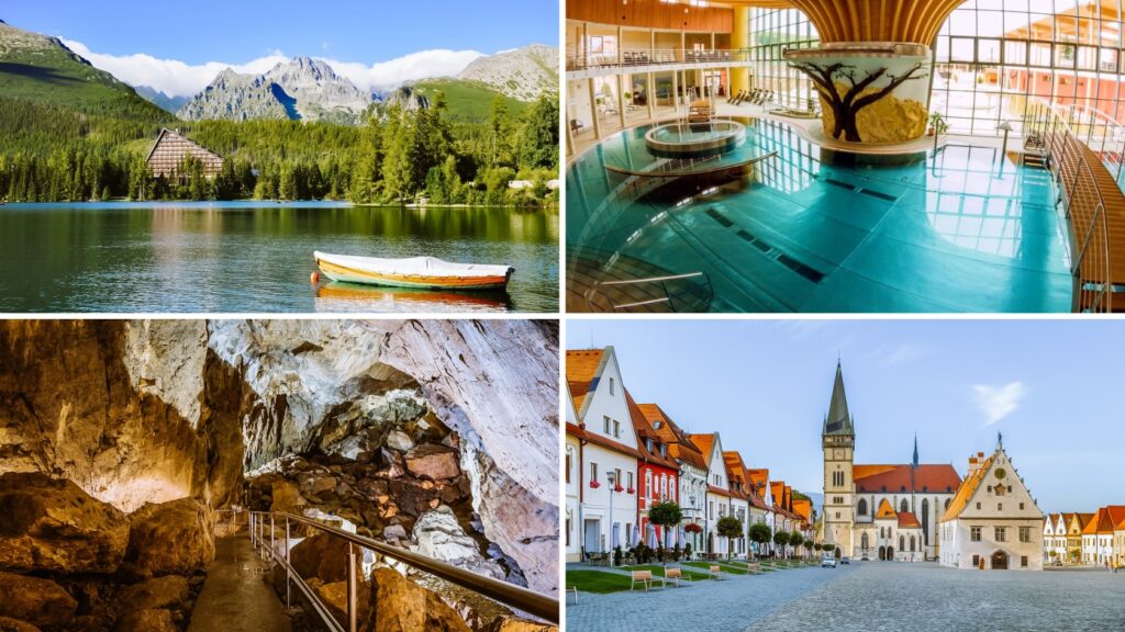
HIGH TATRAS: See the complete guide to the High Tatras (transport, accommodation, easy and day hikes, excursions).
LOW TATRAS: We share tips for the most beautiful places in the Low Tatras in a separate article.
SLOVAKIA: Get inspired where to go to the mountains in Slovakia. We have also prepared a detailed article with tips on the best things to do in Slovakia.
Summary of the article Mala Fatra: Things to do and best hikes in Little Fatra, Slovakia
The most popular and, according to many, the most beautiful peak in Slovakia is Veľký Rozsutec. You can take the cable car to the ridge trail, from where it is only a short walk to the highest peak Veľký Kriváň, to the Chalet pod Chlebom, to Malý Kriváň or Chleb. You will experience a wonderful spectacle in the Jánošikova hole gorge system.
One of the most popular easy routes is the basic circuit in Jánošík’s holes. You will also enjoy the Terchovské srdce lookout tower, the statue of Juraj Janosik or the Šútovský waterfall.
The imaginary centre of Malá Fatra is the village of Terchová, from where you are in the heart of the national park in a few minutes. In the guide you will find specific tips with the best value for money on where to stay, including a map to give you a better idea of which places to visit in the area.